Træningsområdet
Træningsområdet is a pitch in Silkeborg Municipality, Central Jutland. Træningsområdet is situated nearby to the peak Bryndumshøj, as well as near the dog park Hundeskoven Århusvej.| Tap on a place to explore it |
Places of Interest Nearby
Highlights include AQUA Akvarium & Dyrepark and Dronningestolen.
AQUA Akvarium & Dyrepark
Zoo
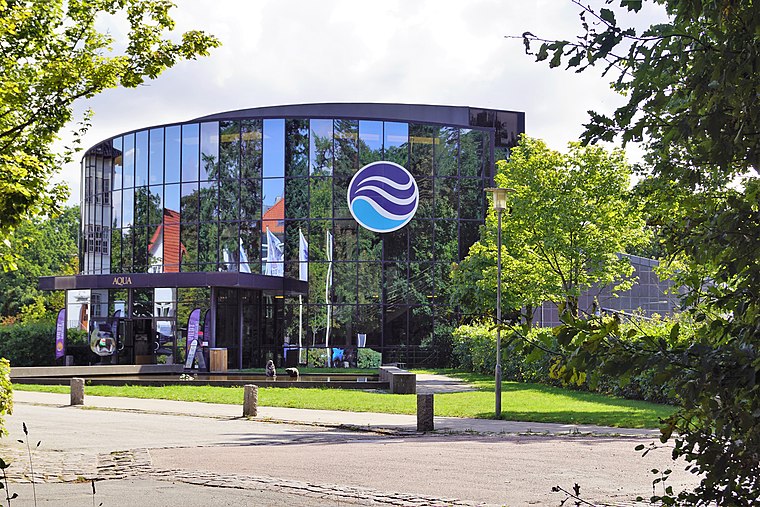
Photo: Nico, CC BY-SA 4.0.
AQUA Akvarium & Dyrepark is a zoo, which is situated 2 km west of Træningsområdet.
Dronningestolen
Scenic viewpoint

Photo: Kim Bach, CC BY-SA 4.0.
Dronningestolen is a scenic viewpoint, which is situated 2 km west of Træningsområdet.
Klüwers Kanal
Canal

Photo: Nico, CC BY-SA 4.0.
Klüwers Kanal is a canal, which is situated 2 km southwest of Træningsområdet.
Places in the Area
Nearby places include Silkeborg and Sejs-Svejbæk.
Silkeborg

Photo: Krists Luhaers, CC BY 2.0.
Silkeborg is a town in Jutland founded in 1844 around a paper mill at the Gudenå River. The history of the place goes back to the 15th century, when a castle was located at an islet in the lake of Silkeborg.
Sejs-Svejbæk
Village
Sejs-Svejbæk is a railway town, with a population of 4,677. It is located in Silkeborg Municipality, Central Jutland Region in Denmark, 7 km southeast of Silkeborg. Sejs-Svejbæk is situated 3 km southeast of Træningsområdet.
Virklund
Village

Photo: Beethoven9, CC BY-SA 4.0.
Virklund is a town in Denmark, located about 5 km south of Silkeborg, to which it functions as a satellite city. It has a population of 3,923. Virklund is located in Silkeborg Municipality and therefore is part of the Central Denmark Region. Virklund is situated 4 km southwest of Træningsområdet.
Træningsområdet
- Type: Pitch
- Categories: recreation area and sports location
- Location: Silkeborg Municipality, Central Jutland, Denmark, Nordic countries, Europe
- View on OpenStreetMap
Latitude
56.15972° or 56° 9′ 35″ northLongitude
9.59055° or 9° 35′ 26″ eastOpen location code
9F8F5H5R+V6OpenStreetMap ID
way 1086278314OpenStreetMap feature
leisure=pitchOpenStreetMap feature
sport=mtb
This page is based on OpenStreetMap, Wikidata, and Wikimedia Commons.
We’d love your help improving our open data sources. Thank you for contributing.
Satellite Map
Discover Træningsområdet from above in high-definition satellite imagery.
Notable Places Nearby
Highlights include Bryndumshøj and Hundeskoven Århusvej.
Nearby Places
Explore places such as Korsdalshuspladsen and Sokær.
Denmark: Must-Visit Destinations
Delve into Copenhagen, Aarhus, Odense, and Aalborg.
Curious Pitches to Discover
Uncover intriguing pitches from every corner of the globe.
About Mapcarta. Data © OpenStreetMap contributors and available under the Open Database License". Text is available under the CC BY-SA 4.0 license, except for photos, directions, and the map. Photo: Wikimedia, CC BY-SA 3.0.