Rüesselihof
Rüesselihof is a farm in Canton of Zug, Switzerland. Rüesselihof is situated nearby to the bowling alley Cherry Bowl, as well as near the church Kirche St. Maria Walterswil.| Tap on a place to explore it |
Places of Interest Nearby
Highlights include Baarburg and Sihl.

Sihl
River
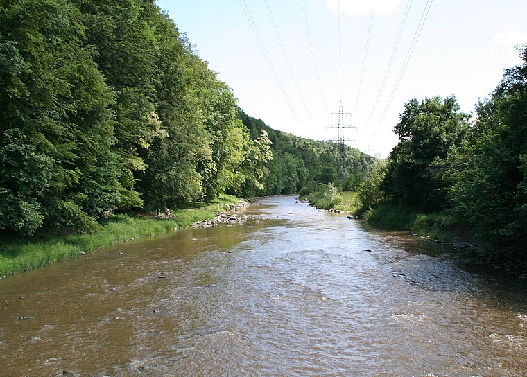
Photo: Parpan05, CC BY-SA 3.0.
The Sihl is a Swiss river that rises near the Druesberg mountain in the canton of Schwyz, and eventually flows into the Limmat in the centre of the city of Zürich, after crossing the Zürich–Winterthur railway at Zürich HB. Sihl is situated 3½ km northeast of Rüesselihof.
Baar railway station
Railway station
 Baar railway station is a railway station in the Swiss canton of Zug, situated in the municipality of Baar. The station is located on the Thalwil–Arth-Goldau railway and is an intermediate stop for InterRegio trains from Zürich to Lucerne and on Zürich S-Bahn line S24. Baar railway station is situated 3 km southwest of Rüesselihof.
Places in the Area
Nearby places include Sihlbrugg and Neuheim.
Sihlbrugg
Village
Photo: Paebi, CC BY-SA 3.0.
Sihlbrugg is a village and important transportation node between the cantons of Zug and Zürich in Switzerland.
Neuheim
Village
Photo: Ikiwaner, CC BY-SA 3.0.
Neuheim is a municipality in the canton of Zug in Switzerland.
Kappel am Albis
Village

Photo: Schulerst, CC BY-SA 3.0.
Kappel am Albis is a municipality in the district of Affoltern in the canton of Zürich in Switzerland. Its name of Kappel is specified by "on the Albis" to distinguish it from two other villages called Kappel in Switzerland. Kappel am Albis is situated 2½ km northwest of Rüesselihof.
Rüesselihof
- Type: Farm
- Categories: locality and agriculture
- Location: Canton of Zug, Switzerland, Central Europe, Europe
- View on OpenStreetMap
Latitude
47.21518° or 47° 12′ 55″ northLongitude
8.55349° or 8° 33′ 13″ eastOpen location code
8FVC6H83+39OpenStreetMap ID
way 1107939719OpenStreetMap feature
landuse=farmyardOpenStreetMap feature
place=farm
This page is based on OpenStreetMap, Wikidata, and Wikimedia Commons.
We’d love your help improving our open data sources. Thank you for contributing.
Satellite Map
Discover Rüesselihof from above in high-definition satellite imagery.
Notable Places Nearby
Highlights include Cherry Bowl and Kirche St. Maria Walterswil.
Nearby Places
Explore places such as Büessikon and Unter Büessikon.
Switzerland: Must-Visit Destinations
Delve into Zurich, Berne, Geneva, and Basel.
Curious Farms to Discover
Uncover intriguing farms from every corner of the globe.
About Mapcarta. Data © OpenStreetMap contributors and available under the Open Database License". Text is available under the CC BY-SA 4.0 license, except for photos, directions, and the map. Photo: Simonizer, CC BY-SA 2.0 de.