Peyrolles-en-Provence - Le Moulin
Peyrolles-en-Provence - Le Moulin is a shelter in Bouches-du-Rhône, Provence-Alpes-Côte d’Azur. Peyrolles-en-Provence - Le Moulin is situated nearby to the fire station Forestiers-Sapeurs - Unité de Peyrolles-en-Provence, as well as near Centre d’incendie et de secours de Concors.| Tap on a place to explore it |
Places of Interest Nearby
Highlights include Abbaye Notre-Dame-de-Fidélité de Jouques and Église Saint-Pierre de Peyrolles-en-Provence.
Abbaye Notre-Dame-de-Fidélité de Jouques
Monastery

Photo: Durnerin, CC BY-SA 3.0.
Abbaye Notre-Dame-de-Fidélité de Jouques is a monastery, which is situated 2 km east of Peyrolles-en-Provence - Le Moulin.
Église Saint-Pierre de Peyrolles-en-Provence
Church

Photo: Okki, CC BY-SA 3.0.
Église Saint-Pierre de Peyrolles-en-Provence is a church, which is situated 1½ km west of Peyrolles-en-Provence - Le Moulin.
Chapelle du Saint-Sépulcre
Chapel

Photo: Okki, CC BY-SA 3.0.
Chapelle du Saint-Sépulcre is situated 1½ km west of Peyrolles-en-Provence - Le Moulin.
Places in the Area
Nearby places include Mirabeau and Pertuis.
Mirabeau
Village

Photo: Yelkrokoyade, CC BY-SA 2.0 fr.
Mirabeau is a commune in the Vaucluse department in the Provence-Alpes-Côte d'Azur region in southeastern France. It has several buildings from the 13th century in the centre, including the Chapelle Sainte-Madeleine. Mirabeau is situated 8 km northeast of Peyrolles-en-Provence - Le Moulin.
Pertuis
Town

Photo: Ampon, CC BY-SA 3.0.
Pertuis is a commune in Vaucluse, a department in the southeastern Provence-Alpes-Côte d'Azur region of France, south of the Luberon. Pertuis has existed since at least 981, and a castle was first built in the 12th century. Pertuis is situated 9 km northwest of Peyrolles-en-Provence - Le Moulin.
Saint-Paul-lès-Durance
Village
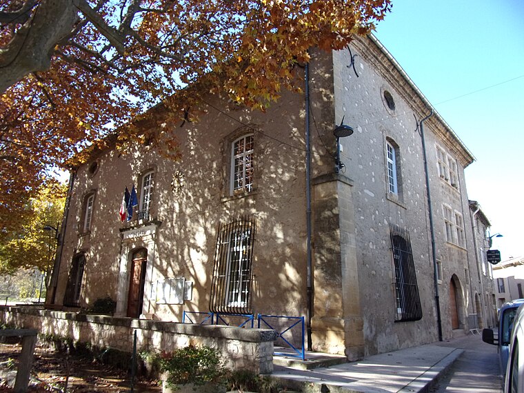
Photo: Marianne Casamance, CC BY-SA 4.0.
Saint-Paul-lès-Durance is a commune in the Bouches-du-Rhône department in Provence, southern France. The Cadarache research center for nuclear energy is located in Saint-Paul-lès-Durance and next to it the international nuclear fusion research and engineering megaproject ITER one of the most expensive buildings ever built and the largest scientific research collaboration in history. Saint-Paul-lès-Durance is situated 9 km northeast of Peyrolles-en-Provence - Le Moulin.
Peyrolles-en-Provence - Le Moulin
- Type: Shelter
- Location: Bouches-du-Rhône, Provence-Alpes-Côte d’Azur, France, Europe
- View on OpenStreetMap
Latitude
43.64906° or 43° 38′ 57″ northLongitude
5.60222° or 5° 36′ 8″ eastOpen location code
8FM7JJX2+JVOpenStreetMap ID
way 1119806815OpenStreetMap feature
amenity=shelter
This page is based on OpenStreetMap, Wikidata, and Wikimedia Commons.
We’d love your help improving our open data sources. Thank you for contributing.
Satellite Map
Discover Peyrolles-en-Provence - Le Moulin from above in high-definition satellite imagery.
Notable Places Nearby
Highlights include Forestiers-Sapeurs - Unité de Peyrolles-en-Provence and Centre d’incendie et de secours de Concors.
Nearby Places
Explore places such as Peyrolles-en-Provence - Le Moulin and Domaine de Moulin.
Bouches-du-Rhône: Must-Visit Destinations
Delve into Marseille, Aix-en-Provence, Arles, and Salon-de-Provence.
Curious Shelters to Discover
Uncover intriguing shelters from every corner of the globe.
About Mapcarta. Data © OpenStreetMap contributors and available under the Open Database License". Text is available under the CC BY-SA 4.0 license, except for photos, directions, and the map. Photo: Benh, CC BY-SA 3.0.