Figer
Figer is a building in Kals, Lienz District, Tyrol which is located on Lana. Figer is situated nearby to the church Lourdeskapelle, as well as near the protected area Schutzzone Objektschutzwald.| Tap on a place to explore it |
Places of Interest Nearby
Highlights include Widum and Pfarrkirche hl. Rupert, Kals am Großglockner.
Widum
Public building

Photo: Jürgele, CC BY-SA 3.0 at.
Widum is a public building, which is situated 770 metres northeast of Figer.
Pfarrkirche hl. Rupert, Kals am Großglockner
Church
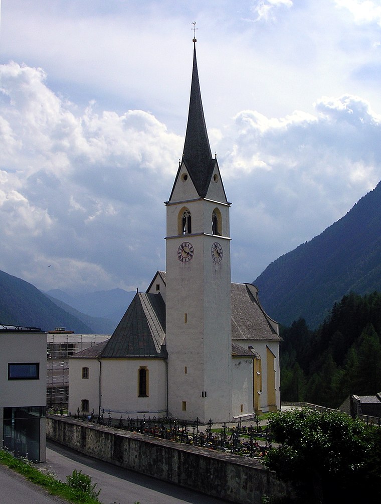 Pfarrkirche hl. Rupert, Kals am Großglockner is a church, which is situated 760 metres northeast of Figer.
Heiliger Georg
Church

Photo: Geiserich77, CC BY-SA 3.0.
Heiliger Georg is a church, which is situated 1¼ km northeast of Figer.
Places in the Area
Nearby places include Großdorf and Burg.


Daberklamm
Locality

Photo: Wikimedia, CC BY-SA 3.0 at.
Daberklamm is a locality, which is situated 4 km north of Figer.
Figer
- Type: Building
- Address: Lana 1, Lana, Kals am Großglockner, 9981
- Location: Kals, Lienz District, Tyrol, Austria, Central Europe, Europe
- View on OpenStreetMap
Latitude
46.99647° or 46° 59′ 47″ northLongitude
12.63709° or 12° 38′ 14″ eastOpen location code
8FRJXJWP+HROpenStreetMap ID
way 112460076OpenStreetMap feature
building=yes
This page is based on OpenStreetMap, Wikidata, and Wikimedia Commons.
We’d love your help improving our open data sources. Thank you for contributing.
Satellite Map
Discover Figer from above in high-definition satellite imagery.
Notable Places Nearby
Highlights include Lourdeskapelle and Schutzzone Objektschutzwald.
Nearby Places
Explore places such as Lourdeskapelle and Cafe Tyrol.
Tyrol: Must-Visit Destinations
Delve into Innsbruck, Kufstein, Lienz, and Kitzbühel.
Curious Buildings to Discover
Uncover intriguing buildings from every corner of the globe.
About Mapcarta. Data © OpenStreetMap contributors and available under the Open Database License". Text is available under the CC BY-SA 4.0 license, except for photos, directions, and the map. Photo: MatthiasKabel, CC BY-SA 4.0.