Dietlbüheln
Dietlbüheln is a locality in Grundlsee, Liezen District, Styria. Dietlbüheln is situated nearby to the locality Weitgrube, as well as near Feuertalscharte.| Tap on a place to explore it |
Places of Interest
Highlights include Spitzmauer and Großer Hochkasten.
Spitzmauer
Peak

Photo: Ondřej Žváček, CC BY 2.5.
With its summit at 2,446 metres above sea level, the Spitzmauer is the second highest mountain of the Totes Gebirge mountain range in the south of Upper Austria.


Places in the Area
Nearby places include In der Röll and Elmgrube.
In der Röll
Locality
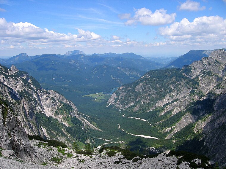
Photo: Tigerente, CC BY-SA 4.0.
In der Röll is a locality, which is situated 6 km northwest of Dietlbüheln.
Elmgrube
Locality

Photo: Tigerente, CC BY-SA 4.0.
Elmgrube is a locality, which is situated 7 km west of Dietlbüheln.
Dietlbüheln
- Type: Locality
- Category: hill
- Location: Grundlsee, Liezen District, Styria, Austria, Central Europe, Europe
- View on OpenStreetMap
Latitude
47.68698° or 47° 41′ 13″ northLongitude
14.04418° or 14° 2′ 39″ eastOpen location code
8FVPM2PV+QMOpenStreetMap ID
way 1131121785OpenStreetMap feature
natural=hillOpenStreetMap feature
place=locality
This page is based on OpenStreetMap, Wikidata, and Wikimedia Commons.
We’d love your help improving our open data sources. Thank you for contributing.
Satellite Map
Discover Dietlbüheln from above in high-definition satellite imagery.
Localities in the Area
Explore places such as Weitgrube and Feuertalscharte.
Notable Places Nearby
Highlights include Doline and Meisenberg.
Styria: Must-Visit Destinations
Delve into Graz, Leoben, Bruck an der Mur, and Kapfenberg.
Curious Localities to Discover
Uncover intriguing localities from every corner of the globe.
About Mapcarta. Data © OpenStreetMap contributors and available under the Open Database License". Text is available under the CC BY-SA 4.0 license, except for photos, directions, and the map. Photo: Kmarka, CC BY-SA 3.0.