Escola Sant Àngel
Escola Sant Àngel is a school in Camarles Municipality, Tarragona, Catalonia. Escola Sant Àngel is situated nearby to the public building Policia Local de Camarles, as well as near the town hall Ajuntament de Camarles.| Tap on a place to explore it |
Places of Interest Nearby
Highlights include Torre de la Granadella and Torre de Camarles.
Torre de la Granadella
Public building
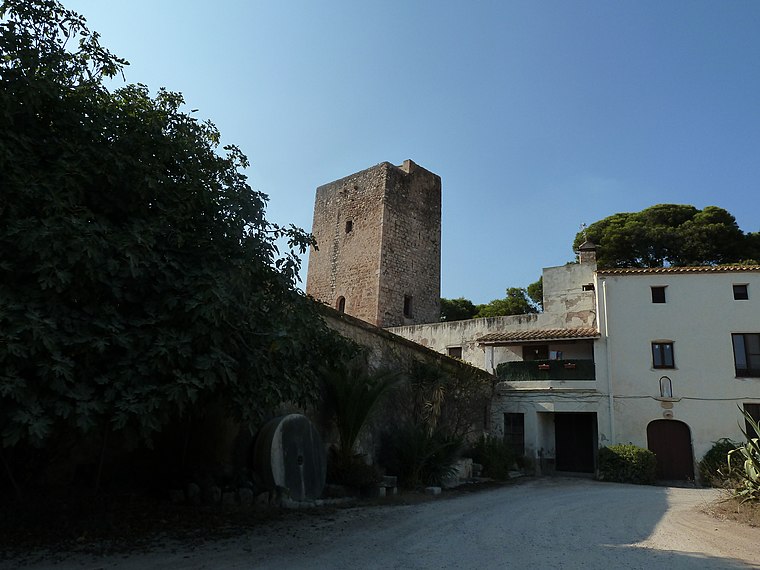
Photo: Deosringas, CC BY-SA 3.0.
Torre de la Granadella is a public building, which is situated 710 metres southwest of Escola Sant Àngel.
Torre de Camarles
Castle

Photo: Deosringas, CC BY-SA 3.0.
Torre de Camarles is a castle, which is situated 760 metres northeast of Escola Sant Àngel.
Places in the Area
Nearby places include L’Aldea Municipality and l’Ampolla Municipality.
L’Aldea Municipality
Village

Photo: Xufanc, CC BY-SA 3.0.
L'Aldea is a municipality in the comarca of the Baix Ebre in Catalonia, Spain. It was created in 1983 from parts of the municipality of Tortosa. It has a population of 4,471. L’Aldea Municipality is situated 5 km southwest of Escola Sant Àngel.
l’Ampolla Municipality
Village

Photo: Wikimedia, Public domain.
L'Ampolla is a municipality in the comarca of the Baix Ebre in Catalonia, Spain. It was created in 1990 by the division of the municipality of el Perelló. l’Ampolla Municipality is situated 6 km northeast of Escola Sant Àngel.
Balada
Hamlet

Photo: Xufanc, CC BY-SA 3.0.
Balada is a hamlet, which is situated 7 km south of Escola Sant Àngel.
Escola Sant Àngel
- Type: School
- Categories: Catalonian school and education
- Location: Camarles Municipality, Tarragona, Catalonia, Eastern Spain, Spain, Iberia, Europe
- View on OpenStreetMap
Latitude
40.77219° or 40° 46′ 20″ northLongitude
0.66826° or 0° 40′ 6″ eastOpen location code
8FG2QMC9+V8OpenStreetMap ID
way 1134459520OpenStreetMap feature
amenity=schoolWikidata ID
Q111309662
This page is based on OpenStreetMap, Wikidata, and Wikimedia Commons.
We’d love your help improving our open data sources. Thank you for contributing.
Satellite Map
Discover Escola Sant Àngel from above in high-definition satellite imagery.
In Other Languages
From Catalan to Spanish—“Escola Sant Àngel” goes by many names.
- Catalan: “Escola Sant Àngel”
- Spanish: “Escola Sant Àngel”
Notable Places Nearby
Highlights include Policia Local de Camarles and Ajuntament de Camarles.
Nearby Places
Explore places such as Farmàcia Molina Cabrera, Laura and Farmàcia Fortuño Beltran, Jordi.
Tarragona: Must-Visit Destinations
Delve into Tarragona, Reus, Tortosa, and Salou.
Curious Schools to Discover
Uncover intriguing schools from every corner of the globe.
About Mapcarta. Data © OpenStreetMap contributors and available under the Open Database License". Text is available under the CC BY-SA 4.0 license, except for photos, directions, and the map. Photo: Lluket, CC BY-SA 3.0.