Akron BMV - Wolf Ledges
Akron BMV - Wolf Ledges is a government office in Summit, Ohio. Akron BMV - Wolf Ledges is situated nearby to United States Post Office - Akron, Ohio, as well as near St Paul Fire Baptized Holiness Church.| Tap on a place to explore it |
Places of Interest Nearby
Highlights include 7 17 Credit Union Park and Akron Children’s Hospital.
7 17 Credit Union Park
Stadium
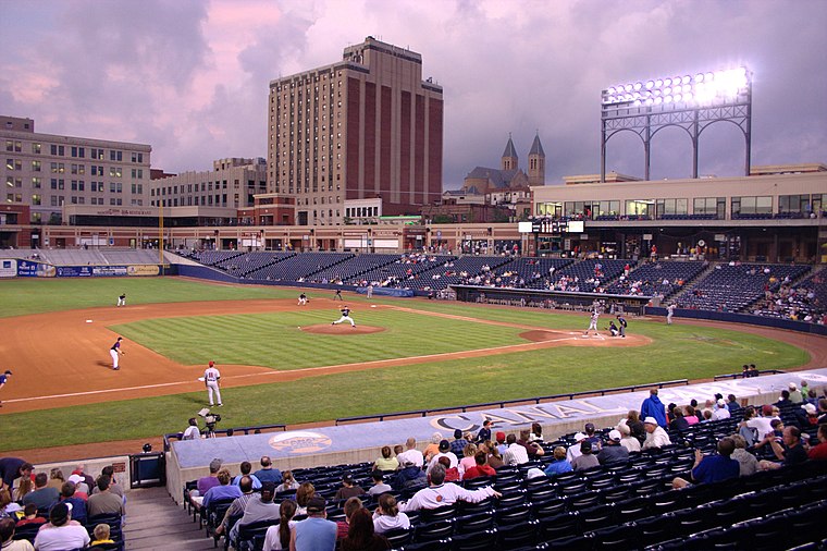
Photo: Rdikeman, CC BY-SA 3.0.
7 17 Credit Union Park is a baseball stadium in Akron, Ohio, United States, and the home of the Akron RubberDucks of the Eastern League, the Double-A minor-league affiliate of the Cleveland Guardians. 7 17 Credit Union Park is situated 1 mile north of Akron BMV - Wolf Ledges.
Akron Children’s Hospital
Hospital
Akron Children's Hospital is a pediatric acute care hospital in Northeast Ohio that provides care to infants, children, adolescents, young adults, aged 0–21 and even some older adults. Akron Children’s Hospital is situated 1 mile north of Akron BMV - Wolf Ledges.
InfoCision Stadium–Summa Field
Pitch

Photo: JEN9841, CC BY-SA 3.0.
InfoCision Stadium–Summa Field is a college American football stadium in Akron, Ohio and the home field of the Akron Zips football team at the University of Akron. InfoCision Stadium–Summa Field is situated 1 mile northeast of Akron BMV - Wolf Ledges.
Places in the Area
Nearby places include Akron and Rolling Acres.
Akron

Photo: Wikimedia, CC BY-SA 3.0.
Akron is a city of almost 200,000 people in the Northeast Ohio region in Summit County. Akron is proud of its heritage as a center of industry, and now offers visitors a wide range of recreational and cultural attractions, food experiences, and shopping.
Rolling Acres
Neighborhood
Rolling Acres is a former shopping district in Akron, Ohio, surrounding the now-demolished Rolling Acres Mall. Planning for the area began in 1960s with Forest City Enterprises, a Cleveland real estate company and the powerful Buchholzer family, whose previous endeavors involved financing much of the Chapel Hill Mall area. Rolling Acres is situated 3 miles west of Akron BMV - Wolf Ledges.
Sawyerwood
Village
Sawyerwood is an unincorporated community and census-designated place in north-central Springfield Township, Summit County, Ohio, United States. Sawyerwood is situated 4½ miles southeast of Akron BMV - Wolf Ledges.
Akron BMV - Wolf Ledges
- Type: Government office
- Categories: building, office, and government building
- Location: Summit, Ohio, Midwest, United States, North America
- View on OpenStreetMap
Latitude
41.0649° or 41° 3′ 54″ northLongitude
-81.52108° or 81° 31′ 16″ westOperator
Ohio Bureau of Motor VehiclesOpen location code
86HW3F7H+XHOpenStreetMap ID
way 1134682786OpenStreetMap feature
building=yesOpenStreetMap feature
office=government
This page is based on OpenStreetMap, Wikidata, and Wikimedia Commons.
We’d love your help improving our open data sources. Thank you for contributing.
Satellite Map
Discover Akron BMV - Wolf Ledges from above in high-definition satellite imagery.
Notable Places Nearby
Highlights include United States Post Office - Akron, Ohio and St Paul Fire Baptized Holiness Church.
Nearby Places
Explore places such as Laborers‘ International Union of North America and Alpha Phi Alpha Homes.
Ohio: Must-Visit Destinations
Delve into Columbus, Cincinnati, Cleveland, and Bowling Green.
Curious Government Offices to Discover
Uncover intriguing government offices from every corner of the globe.
About Mapcarta. Data © OpenStreetMap contributors and available under the Open Database License". Text is available under the CC BY-SA 4.0 license, except for photos, directions, and the map. Photo: Wikimedia, CC0.