Parkplatz Laube
Parkplatz Laube is a parking area in Lower Saxony, Germany. Parkplatz Laube is situated nearby to 1754-1954 Wennigsen--Argestorfer Genossenschaftsforst, as well as near the peak Samkekopf.| Tap on a place to explore it |
Places of Interest Nearby
Highlights include Anna-Tower and Bröhn.
Anna-Tower
Scenic viewpoint
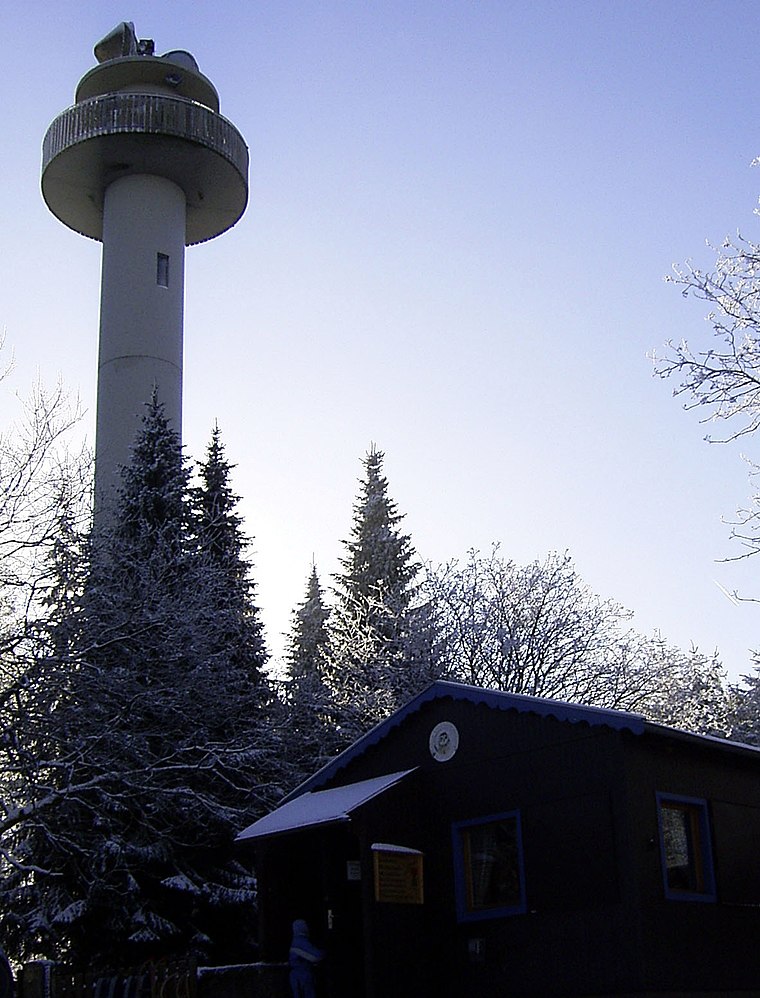
Photo: Tortuosa, CC BY-SA 3.0.
Anna-Tower is a scenic viewpoint, which is situated 2 km northwest of Parkplatz Laube.
Bröhn
Peak

Photo: Den man tau, CC BY-SA 3.0.
The Bröhn is the highest hill in the Deister range in the German state of Lower Saxony, reaching 405 metres. It owes its name to the broom growing here.
Eltendenkmal
Memorial

Photo: Fitsche, CC BY-SA 3.0.
Eltendenkmal is a memorial, which is situated 1¼ km north of Parkplatz Laube.
Places in the Area
Nearby places include Georgsplatz and Waldkater.

Waldkater
Hamlet

Photo: Den man tau, CC BY-SA 4.0.
Waldkater is a hamlet, which is situated 3 km northeast of Parkplatz Laube.
Springe
Town

Photo: Gerhard kemme, CC0.
Springe is a town in the district of Hanover, in Lower Saxony, Germany. It is situated near the Deister hills, 22 kilometres southwest of Hanover. Springe is situated 3½ km southeast of Parkplatz Laube.
Parkplatz Laube
- Type: Parking area
- Parking: surface
- Category: transportation
- Location: Lower Saxony, Germany, Central Europe, Europe
- View on OpenStreetMap
Latitude
52.23825° or 52° 14′ 18″ northLongitude
9.53264° or 9° 31′ 58″ eastOpen location code
9F4F6GQM+73OpenStreetMap ID
way 1142190303OpenStreetMap feature
amenity=parkingOpenStreetMap attribute
parking=surface
This page is based on OpenStreetMap, Wikidata, and Wikimedia Commons.
We’d love your help improving our open data sources. Thank you for contributing.
Satellite Map
Discover Parkplatz Laube from above in high-definition satellite imagery.
Notable Places Nearby
Highlights include 1754-1954 Wennigsen--Argestorfer Genossenschaftsforst and Samkekopf.
Nearby Places
Explore places such as Start Loipe Ski-Club-Springe and Sonnenhütte.
Lower Saxony: Must-Visit Destinations
Delve into Hanover, Göttingen, Brunswick, and Wolfsburg.
Curious Parking Areas to Discover
Uncover intriguing parking areas from every corner of the globe.
About Mapcarta. Data © OpenStreetMap contributors and available under the Open Database License". Text is available under the CC BY-SA 4.0 license, except for photos, directions, and the map. Photo: Danapit, CC BY-SA 3.0.