Kenilwood
Kenilwood is in Borough of Bernardsville, Somerset County, New Jersey. Kenilwood is situated nearby to Church of Saint John of the Mountain, as well as near the peak Mine Mountain.| Tap on a place to explore it |
Places of Interest Nearby
Highlights include Natirar and Bernardsville station.
Natirar
Nature reserve

Photo: Ekem, CC BY-SA 3.0.
Natirar is an estate spanning 491 acres of the estate have been leased to develop that portion of the estate into an exclusive hotel, spa, restaurant complex. Natirar is situated 2 miles southwest of Kenilwood.
Bernardsville station
Railway station

Photo: Adam Moss, CC BY-SA 2.0.
Bernardsville is a New Jersey Transit station in Bernardsville, Somerset County, New Jersey along the Gladstone Branch of the Morris & Essex Lines, in the United States. Bernardsville station is situated 2½ miles east of Kenilwood.
Blairsden
House
Blairsden is a historic 62,000-square-foot. In addition to its 38 rooms, the mansion has 25 fireplaces and 19 bathrooms. Blairsden is situated 1¼ miles west of Kenilwood.
Places in the Area
Nearby places include Bernardsville and Gladstone.
Bernardsville
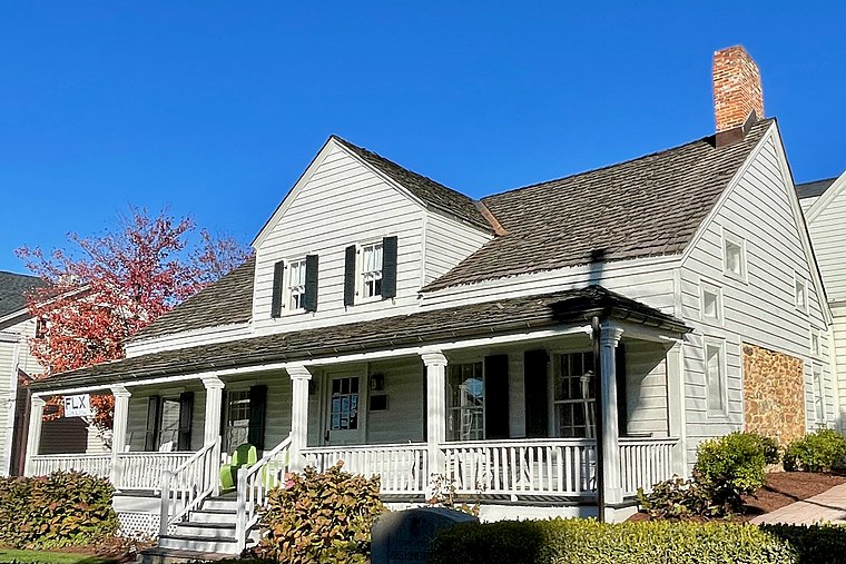
Photo: Zeete, CC BY-SA 4.0.
Bernardsville is a small, affluent town located in the Skylands region in northern New Jersey. It is in Somerset County, which is in the top ten wealthiest counties in the nation.
Gladstone
Hamlet
Gladstone is an unincorporated community located within Peapack-Gladstone in Somerset County, in the U.S. state of New Jersey. The area is served as United States Postal Service ZIP Code 07934. Gladstone is situated 2½ miles west of Kenilwood.
Far Hills

Photo: KLOTZ, CC BY-SA 3.0.
Far Hills is a borough in the Somerset Hills of northern Somerset County in the U.S. state of New Jersey. As of the 2020 United States census, the borough's population was 924, an increase of 5 from the 2010 census count of 919, which in turn reflected an increase of 60 from the 859 counted in the 2000 census.
Kenilwood
- Type: Agricultural land
- Category: agriculture
- Location: Borough of Bernardsville, Somerset County, Skylands, New Jersey, Mid-Atlantic, United States, North America
- View on OpenStreetMap
Latitude
40.72044° or 40° 43′ 14″ northLongitude
-74.61631° or 74° 36′ 59″ westOpen location code
87G7P9CM+5FOpenStreetMap ID
way 1144243989OpenStreetMap feature
landuse=farmland
This page is based on OpenStreetMap, Wikidata, and Wikimedia Commons.
We’d love your help improving our open data sources. Thank you for contributing.
Satellite Map
Discover Kenilwood from above in high-definition satellite imagery.
Places with the Same Name
Discover other places named “Kenilwood”.
Notable Places Nearby
Highlights include Church of Saint John of the Mountain and Mine Mountain.
Nearby Places
Explore places such as North Branch Raritan River near Far Hills and Far Hills USGS Unheated Rain Gage.
Somerset County: Must-Visit Destinations
Delve into Somerville, Manville, Somerset, and Bernardsville.
Curious Places to Discover
Uncover intriguing places from every corner of the globe.
About Mapcarta. Data © OpenStreetMap contributors and available under the Open Database License". Text is available under the CC BY-SA 4.0 license, except for photos, directions, and the map. Photo: Wikimedia, CC0.