Triangle Town Place
Triangle Town Place is a commercial area in Township of Neuse, Wake, North Carolina. Triangle Town Place is situated nearby to the health club Curves, as well as near the shopping center Triangle Town Center.| Tap on a place to explore it |
Places of Interest Nearby
Highlights include Triangle Town Center and Millbrook High School.
Triangle Town Center
Shopping center
Triangle Town Center is a shopping mall in Raleigh, North Carolina. It is located in North Raleigh off U.S. Highway 1 and Interstate 540. The mall features the traditional retailers Belk, Dillard's, Macy's, and Saks Fifth Avenue. Triangle Town Center is situated 1,500 feet north of Triangle Town Place.
Millbrook High School
School

Photo: Mx. Granger, CC0.
Millbrook Magnet High School, commonly known as Millbrook High School, is a public magnet high school located in Raleigh, North Carolina. It is one of thirty-two high schools in the Wake County Public School System. Millbrook High School is situated 1½ miles west of Triangle Town Place.
North Raleigh Christian Academy
School
North Raleigh Christian Academy is a private, coeducational, primary and secondary Christian day school located in Raleigh, North Carolina, United States. Also referred to as simply North Raleigh Christian, the school was founded in 1996. North Raleigh Christian Academy is situated 2½ miles northeast of Triangle Town Place.
Places in the Area
Nearby places include Millbrook and North Hills.
Millbrook
Suburb
Millbrook, North Carolina, United States, was a village in Wake County at that time in the intersection of then Wake Forest Road and then Main Street, which is now part of East Millbrook Road. Millbrook is situated 1½ miles southwest of Triangle Town Place.
North Hills
Neighborhood

Photo: Cgb628, CC BY-SA 3.0.
North Hills is a mixed use development located in Raleigh, North Carolina that includes stores, restaurants, entertainment, commercial offices, residential living and a continuing care retirement community. North Hills is situated 4½ miles west of Triangle Town Place.
Historic Oakwood
Neighborhood
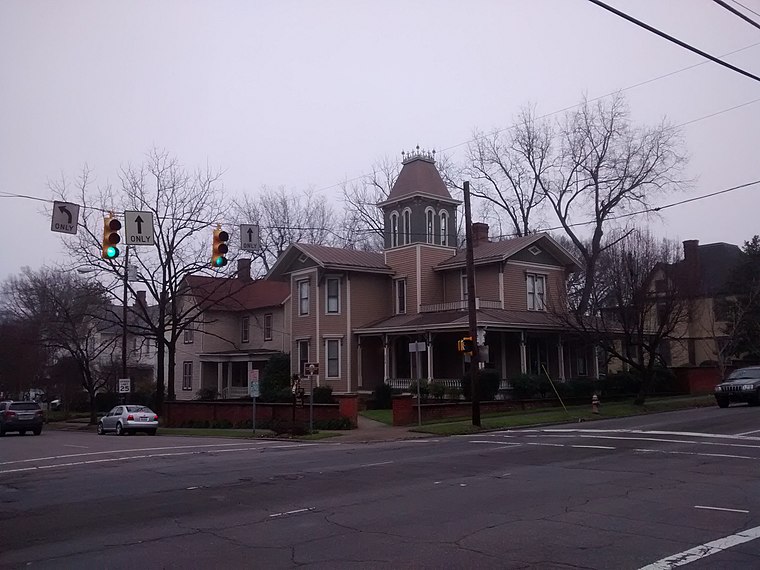
Photo: Mx. Granger, CC0.
Historic Oakwood is a neighborhood in downtown Raleigh, North Carolina, United States, on the National Register of Historic Places, and known for its Historic Oakwood Cemetery, its many Victorian houses and its location close to the Mordecai Plantation Manor. Historic Oakwood is situated 6 miles southwest of Triangle Town Place.
Triangle Town Place
- Type: Commercial area
- Location: Township of Neuse, Wake, North Carolina, South, United States, North America
- View on OpenStreetMap
Latitude
35.86251° or 35° 51′ 45″ northLongitude
-78.57715° or 78° 34′ 38″ westOpen location code
8773VC7F+24OpenStreetMap ID
way 1145592022OpenStreetMap feature
landuse=retail
This page is based on OpenStreetMap, Wikidata, and Wikimedia Commons.
We’d love your help improving our open data sources. Thank you for contributing.
Satellite Map
Discover Triangle Town Place from above in high-definition satellite imagery.
Notable Places Nearby
Highlights include Curves and Raleigh Police Department-Northeast District.
Nearby Places
Explore places such as Dollar Tree and DSW.
North Carolina: Must-Visit Destinations
Delve into Charlotte, Raleigh, Asheville, and Greensboro.
Curious Commercial Areas to Discover
Uncover intriguing commercial areas from every corner of the globe.
About Mapcarta. Data © OpenStreetMap contributors and available under the Open Database License". Text is available under the CC BY-SA 4.0 license, except for photos, directions, and the map. Photo: southernfoodwaysalliance, CC BY 2.0.