Mas de Moragrega
Mas de Moragrega is a building in Horta de Sant Joan, Tarragona, Catalonia. Mas de Moragrega is situated nearby to the building Mas de Fortunyo, as well as near Mas de Famus.| Tap on a place to explore it |
Places in the Area
Nearby places include Arens de Lledó and Lledó Municipality.
Arens de Lledó
Village

Photo: Carlosky, CC BY-SA 3.0 es.
Arens de Lledó or Arenys de Lledó is a municipality located in the Matarraña/Matarranya comarca, province of Teruel, Aragon, Spain. According to the 2008 census, the municipality has a population of 217 inhabitants, and covers an area of 34.27 square kilometres. Arens de Lledó is situated 3½ km west of Mas de Moragrega.
Lledó Municipality
Village

Photo: Enfo, CC BY-SA 3.0.
Lledó ( or Lledó d'Algars is a municipality located in the Matarraña/Matarranya comarca, province of Teruel, Aragon, Spain. According to the 2004 census, the municipality has a population of 191 inhabitants. Lledó Municipality is situated 5 km southwest of Mas de Moragrega.
Bot Municipality
Village
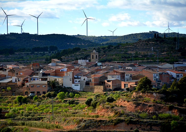
Photo: Wikimedia, CC BY-SA 2.0.
Bot is a town located in the comarca of Terra Alta, province of Tarragona, in Catalonia, Spain. It is located between the Serra de la Solsida and the Serra dels Pesells ranges. Bot Municipality is situated 7 km east of Mas de Moragrega.
Mas de Moragrega
- Type: Building
- Description: building in Horta de Sant Joan, Terra Alta, Tarragona, Catalonia, Spain
- Category: masia
- Location: Horta de Sant Joan, Tarragona, Catalonia, Eastern Spain, Spain, Iberia, Europe
- View on OpenStreetMap
Latitude
40.99513° or 40° 59′ 43″ northLongitude
0.30978° or 0° 18′ 35″ eastOpen location code
8FG2X8W5+3WOpenStreetMap ID
way 1147289312OpenStreetMap feature
building=yesWikidata ID
Q110255616
This page is based on OpenStreetMap, Wikidata, and Wikimedia Commons.
We’d love your help improving our open data sources. Thank you for contributing.
Satellite Map
Discover Mas de Moragrega from above in high-definition satellite imagery.
In Other Languages
From Basque to Portuguese—“Mas de Moragrega” goes by many names.
- Basque: “Mas de Moragrega”
- Catalan: “Mas de Moragrega”
- French: “Mas de Moragrega”
- German: “Mas de Moragrega”
- Occitan (post 1500): “Mas de Moragrega”
- Portuguese: “Mas de Moragrega”
Notable Places Nearby
Highlights include Mas de Fortunyo and Mas de Famus.
Nearby Places
Explore places such as Caseta del Bosc and Mas de Calderera.
Tarragona: Must-Visit Destinations
Delve into Tarragona, Reus, Tortosa, and Salou.
Curious Buildings to Discover
Uncover intriguing buildings from every corner of the globe.
About Mapcarta. Data © OpenStreetMap contributors and available under the Open Database License". Text is available under the CC BY-SA 4.0 license, except for photos, directions, and the map. Photo: Lluket, CC BY-SA 3.0.