Crockettville Country Store
Crockettville Country Store is a convenience store in Hampton, South Carolina which is located on Bamberg Highway. Crockettville Country Store is situated nearby to the hamlet Crocketville, as well as near Harmony Presbyterian Church.| Tap on a place to explore it |
Places in the Area
Nearby places include Crocketville and Miley.
Crocketville
Hamlet
Crocketville is an unincorporated community in Hampton County, South Carolina, United States. The community is located on U.S. Route 601, 3.7 miles northeast of Hampton.
Miley
Hamlet
Miley is an unincorporated hamlet in Hampton County, South Carolina, United States. The community is located along the Hampton and Branchville Railroad, 7.1 miles northeast of Hampton, at and about the intersection of Salkehatchie Road and County Road S-25-29. Miley is situated 3½ miles northeast of Crockettville Country Store.
Hampton
Town
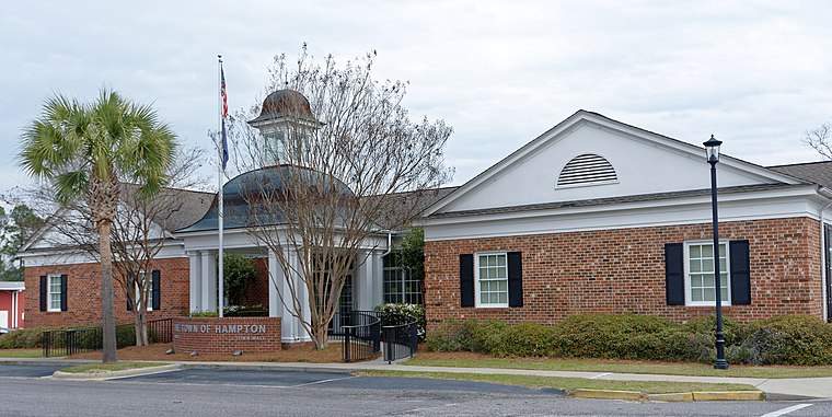
Photo: Bubba73, CC BY-SA 4.0.
Hampton is a town in Hampton County, South Carolina, United States. The population was 2,808 at the 2010 census. It is the county seat of Hampton County. The town and the county are named after Wade Hampton III, a Confederate general in the Civil War. Hampton is situated 4 miles southwest of Crockettville Country Store.
Crockettville Country Store
- Type: Convenience store
- Address: 3820 Bamberg Highway, Hampton, SC 29924
- Categories: building, shop, and food
- Location: Hampton, South Carolina, South, United States, North America
- View on OpenStreetMap
Latitude
32.91559° or 32° 54′ 56″ northLongitude
-81.07858° or 81° 4′ 43″ westOpen location code
864WWW8C+6HOpenStreetMap ID
way 1149748046OpenStreetMap feature
building=yesOpenStreetMap feature
shop=convenience
This page is based on OpenStreetMap, Wikidata, and Wikimedia Commons.
We’d love your help improving our open data sources. Thank you for contributing.
Satellite Map
Discover Crockettville Country Store from above in high-definition satellite imagery.
Notable Places Nearby
Highlights include Harmony Presbyterian Church and Crocketville Cemetery.
Nearby Places
Explore places such as 2052 and 2012.
South Carolina: Must-Visit Destinations
Delve into Columbia, Charleston, Greenville, and Myrtle Beach.
Curious Convenience Stores to Discover
Uncover intriguing convenience stores from every corner of the globe.
About Mapcarta. Data © OpenStreetMap contributors and available under the Open Database License". Text is available under the CC BY-SA 4.0 license, except for photos, directions, and the map. Photo: Rastapopulous, CC BY-SA 3.0.