CHAPELLE 37189 P08
CHAPELLE 37189 P08 is a building in Preuilly-sur-Claise, Arrondissement of Loches, Centre-Val de Loire. CHAPELLE 37189 P08 is situated nearby to the church Chapelle de Tous-les-Saints de Preuilly, as well as near the park Ancien Cimetière.| Tap on a place to explore it |
Places of Interest Nearby
Highlights include Chapelle de Tous-les-Saints de Preuilly and Château des Lions.
Chapelle de Tous-les-Saints de Preuilly
Church

Photo: DoucF, CC BY-SA 3.0.
Chapelle de Tous-les-Saints de Preuilly is a church.
Château des Lions
Castle

Photo: DoucF, CC BY-SA 3.0.
Château des Lions is a castle, which is situated 610 metres east of CHAPELLE 37189 P08.
Ancienne église Notre-Dame-des-Echelles
Church

Photo: DoucF, CC BY-SA 3.0.
Ancienne église Notre-Dame-des-Echelles is a church, which is situated 480 metres east of CHAPELLE 37189 P08.
Places in the Area
Nearby places include Boussay and Chaumussay.
Boussay
Village

Photo: DocteurCosmos, CC BY-SA 3.0.
Boussay is a commune in the Indre-et-Loire department in central France. Boussay is situated 3 km southwest of CHAPELLE 37189 P08.
Chaumussay
Village

Photo: DoucF, CC BY-SA 3.0.
Chaumussay is a commune in the Indre-et-Loire department in central France. Chaumussay is situated 5 km west of CHAPELLE 37189 P08.
Yzeures-sur-Creuse
Village
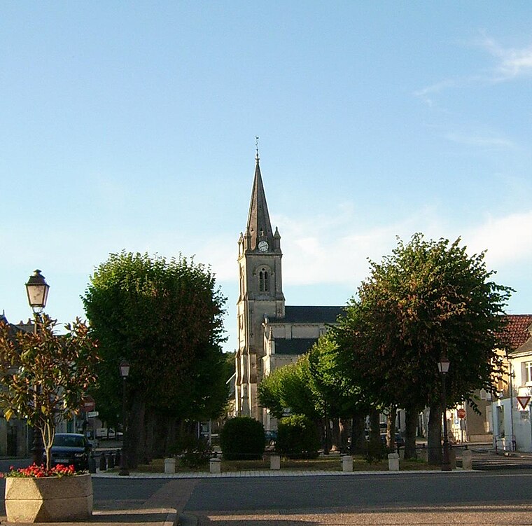
Photo: Lhb-fr, CC BY-SA 3.0.
Yzeures-sur-Creuse is a commune in the department of Indre-et-Loire, Centre-Val de Loire, France. It is one of the oldest towns in Touraine, occupation dating back to the Upper Paleolithic era earlier than 10,0 CE. Yzeures-sur-Creuse is situated 9 km southwest of CHAPELLE 37189 P08.
CHAPELLE 37189 P08
Latitude
46.85627° or 46° 51′ 23″ northLongitude
0.92338° or 0° 55′ 24″ eastOperator
EnedisOpen location code
8FR2VW4F+G9OpenStreetMap ID
way 115896553OpenStreetMap feature
building=service
This page is based on OpenStreetMap, Wikidata, and Wikimedia Commons.
We’d love your help improving our open data sources. Thank you for contributing.
Satellite Map
Discover CHAPELLE 37189 P08 from above in high-definition satellite imagery.
Notable Places Nearby
Highlights include Ancien Cimetière and Cemetery of Preuilly-sur-Claise.
Nearby Places
Explore places such as Le Plan d’Eau and Les Ragots.
Centre-Val de Loire: Must-Visit Destinations
Delve into Orléans, Tours, Chartres, and Bourges.
Curious Buildings to Discover
Uncover intriguing buildings from every corner of the globe.
About Mapcarta. Data © OpenStreetMap contributors and available under the Open Database License". Text is available under the CC BY-SA 4.0 license, except for photos, directions, and the map. Photo: Popolon, CC BY-SA 3.0.