Igreja de Santo André
Igreja de Santo André is a church in Boidobra, Covilhã, Castelo Branco District. Igreja de Santo André is situated nearby to the park Parque Multiusos Duppigheim, as well as near the swimming pool Quinta do sangrinhal (piscina).| Tap on a place to explore it |
- Type: Church
- Denomination: Roman Catholic
- Also known as: “Igreja de Boidobra”
Places of Interest Nearby
Highlights include Complexo Desportivo da Covilhã and Covilhã train station.
Complexo Desportivo da Covilhã
Athletics track
Complexo Desportivo da Covilhã is a multi-use stadium in Covilhã, Portugal. The Complexo Desportivo da Covilhã stadium holds 3,000 seats and the entire space has also infrastructure for volleyball, badminton and athletics. Complexo Desportivo da Covilhã is situated 1½ km north of Igreja de Santo André.
Covilhã train station
Railway station
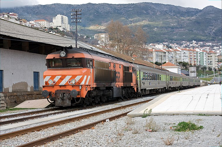
Photo: Nuno Morão, CC BY-SA 2.0.
Covilhã train station is a railway station, which is situated 3 km north of Igreja de Santo André.
Capela de Nossa Senhora dos Remédios (Tortosendo)
Church

Photo: Vitor Oliveira, CC BY-SA 2.0.
Capela de Nossa Senhora dos Remédios (Tortosendo) is a church, which is situated 2½ km west of Igreja de Santo André.
Places in the Area
Nearby places include Boidobra and Ferro.
Boidobra
Town
Boidobra is a civil parish in the municipality of Covilhã, Portugal. The population in 2011 was 3,246, in an area of 16.26 square kilometres.
Ferro
Town
Ferro is a town and civil parish in the municipality of Covilhã, Portugal. The population in 2011 was 1,700, in an area of 30.76 square kilometres. Ferro is the Portuguese word for iron. Ferro is situated 4½ km southeast of Igreja de Santo André.
Dominguizo
Village

Photo: Sacavem, CC BY-SA 3.0.
Dominguizo is a village, which is situated 5 km southwest of Igreja de Santo André.
Igreja de Santo André
- Categories: building, place of worship, and religion
- Location: Boidobra, Covilhã, Castelo Branco District, Portugal, Iberia, Europe
- View on OpenStreetMap
Latitude
40.25264° or 40° 15′ 10″ northLongitude
-7.49295° or 7° 29′ 35″ westOpen location code
8CGJ7G34+3ROpenStreetMap ID
way 1160757555OpenStreetMap feature
amenity=place_of_worshipOpenStreetMap feature
building=churchOpenStreetMap attribute
denomination=roman_catholic
This page is based on OpenStreetMap, Wikidata, and Wikimedia Commons.
We’d love your help improving our open data sources. Thank you for contributing.
Satellite Map
Discover Igreja de Santo André from above in high-definition satellite imagery.
Places with the Same Name
Discover other places named “Igreja de Santo André”.
Notable Places Nearby
Highlights include Parque Multiusos Duppigheim and Quinta do sangrinhal (piscina).
Nearby Places
Explore places such as Escola Básica da Boidobra and Paulo de Oliveira Lanifícios.
Portugal: Must-Visit Destinations
Delve into Lisbon, Caldas da Rainha, Porto, and Coimbra.
Curious Churches to Discover
Uncover intriguing churches from every corner of the globe.
About Mapcarta. Data © OpenStreetMap contributors and available under the Open Database License". Text is available under the CC BY-SA 4.0 license, except for photos, directions, and the map. Photo: Crazy Murdoc, CC BY-SA 3.0.