Volksschule Reininghaus
Volksschule Reininghaus is a school in Gries, Graz, Styria which is located on Am Steinfeld. Volksschule Reininghaus is situated nearby to the sports venue Bezirkssportpark Reininghaus, as well as near the neighborhood Graz Reininghaus.| Tap on a place to explore it |
- Type: School
- Also known as: “VS Reininghaus”
- Address: Am Steinfeld 3, Graz, 8020
- Roof shape: flat
Places of Interest Nearby
Highlights include Graz Hauptbahnhof and St. Lukas.
Graz Hauptbahnhof
Railway station

Photo: Wikimedia, CC BY-SA 1.0 fi.
Graz Hauptbahnhof, abbreviated Graz Hbf, is the main railway station in Graz, the capital of the Austrian federal state Styria. The station is located some 2 kilometres west of the city centre, to which it is connected by tram. Graz Hauptbahnhof is situated 1 km north of Volksschule Reininghaus.
St. Lukas
Church
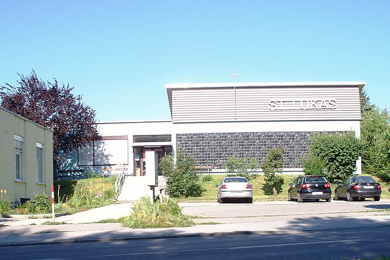 St. Lukas is a church, which is situated 500 metres northeast of Volksschule Reininghaus.
Graz Köflacherbahnhof
Railway station

Photo: Wikimedia, CC BY-SA 3.0.
Graz Köflacherbahnhof is a railway station, which is situated 590 metres north of Volksschule Reininghaus.
Places in the Area
Nearby places include Graz Reininghaus and Gries.
Graz Reininghaus
Neighborhood

Photo: Wikimedia, CC BY-SA 3.0 de.
The grounds of the former Reininghaus brewery, covering 50 hectares, represent the largest undeveloped area near the center of Graz, Austria’s second largest city.
Gries
Suburb
Photo: Freezerfreezer, CC BY-SA 2.5.
Gries is the 5th District of the Austrian city of Graz. It is the location of Graz's red-light district.
Eggenberg
Suburb
Photo: Robodoc, CC BY-SA 3.0.
Eggenberg is the 14th city district of Graz in the Austrian province of Styria. It borders to the districts of Lend and Gries in the east and to the Plabutsch mountain in the west.
Volksschule Reininghaus
- Categories: building, school building, and education
- Location: Gries, Graz, Styria, Austria, Central Europe, Europe
- View on OpenStreetMap
Latitude
47.06298° or 47° 3′ 47″ northLongitude
15.41477° or 15° 24′ 53″ eastInception
2024Levels
3Open location code
8FVQ3C77+5WOpenStreetMap ID
way 1165181961OpenStreetMap feature
amenity=schoolOpenStreetMap feature
building=schoolOpenStreetMap attribute
roof-shape=flat
This page is based on OpenStreetMap, Wikidata, and Wikimedia Commons.
We’d love your help improving our open data sources. Thank you for contributing.
Satellite Map
Discover Volksschule Reininghaus from above in high-definition satellite imagery.
Notable Places Nearby
Highlights include Bezirkssportpark Reininghaus and Tennenmälzerei.
Nearby Places
Explore places such as Schulcampus Reininghaus and Reininghaus - Quartier 12 - Schulquartier.
Styria: Must-Visit Destinations
Delve into Leoben, Bruck an der Mur, Kapfenberg, and Schladming.
Curious Places to Discover
Uncover intriguing places from every corner of the globe.
About Mapcarta. Data © OpenStreetMap contributors and available under the Open Database License". Text is available under the CC BY-SA 4.0 license, except for photos, directions, and the map. Photo: Traveler100, CC BY-SA 3.0.