Cala es Morts
Cala es Morts is a bay in Ciutadella, Balearic Islands, Balearic Islands.| Tap on a place to explore it |
Places of Interest
Highlights include Punta Nati Lighthouse and Coastal Settlement El Coll De Cala Morell.
Punta Nati Lighthouse
Scenic viewpoint
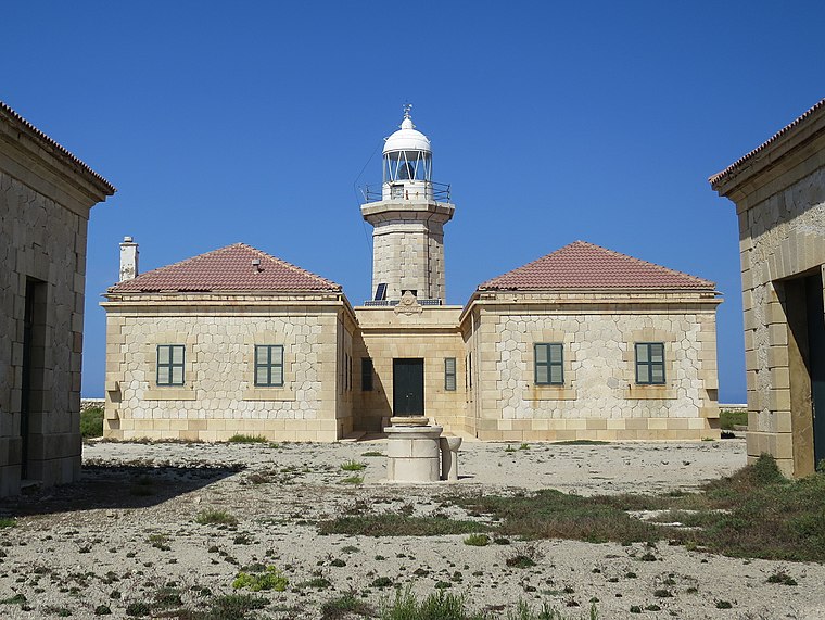
Photo: Ben Salter, CC BY 2.0.
The Punta Nati Lighthouse is an active aid to navigation located on the rocky north western coast of the Spanish island of Menorca. The lighthouse was built following demands from the French authorities to light the northern coast of the island.
Coastal Settlement El Coll De Cala Morell
Archaeological site

Photo: Sa monea, CC BY-SA 3.0.
The settlement of Cala Morell is a Menorcan pre-talayotic archaeological site which is located in Ciutadella de Menorca. It is situated on a 35-meter-high coastal headland which closes the northeast side of Cala Morell's bay.
Cala Morell Necropolis
Archaeological site

Photo: Dreizung, CC BY-SA 4.0.
Cala Morell Necropolis is an archaeological site.
Cala es Morts
- Type: Bay
- Also known as: “Calesmorts”
- Category: body of water
- Location: Ciutadella, Balearic Islands, Menorca, Balearic Islands, Spain, Iberia, Europe
- View on OpenStreetMap
Latitude
40.0512° or 40° 3′ 4″ northLongitude
3.8303° or 3° 49′ 49″ eastOpen location code
8FG53R2J+F4OpenStreetMap ID
way 1167610145OpenStreetMap feature
natural=bay
This page is based on OpenStreetMap, Wikidata, and Wikimedia Commons.
We’d love your help improving our open data sources. Thank you for contributing.
Satellite Map
Discover Cala es Morts from above in high-definition satellite imagery.
Localities in the Area
Explore places such as es Llosar and Bufador de son Salomó.
Notable Places Nearby
Highlights include Cales Pous and Cova des Llosar.
Menorca: Must-Visit Destinations
Delve into Maó, Es Mercadal, Cala Galdana, and Cala en Bosch.
Curious Bays to Discover
Uncover intriguing bays from every corner of the globe.
About Mapcarta. Data © OpenStreetMap contributors and available under the Open Database License". Text is available under the CC BY-SA 4.0 license, except for photos, directions, and the map. Photo: Ben Salter, CC BY 2.0.