Trg siječanjskih žrtava 1945.
Trg siječanjskih žrtava 1945. is a square in Zagreb, Central Croatia. Trg siječanjskih žrtava 1945. is situated nearby to the quarter Kustošija, as well as near the church crkva svetog Nikole Tavelića.| Tap on a place to explore it |
Places of Interest Nearby
Highlights include Hostel Mali Mrak Zagreb and Klinička bolnica ‘Sveti Duh’.
Hostel Mali Mrak Zagreb
Hostel

Photo: Mnalis, CC BY-SA 4.0.
Hostel Mali Mrak Zagreb is situated 140 metres east of Trg siječanjskih žrtava 1945..
Klinička bolnica ‘Sveti Duh’
Hospital
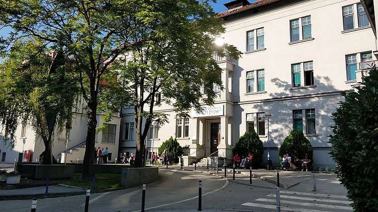
Photo: Janjko, CC BY-SA 4.0.
Klinička bolnica ‘Sveti Duh’ is a hospital, which is situated 1¼ km northeast of Trg siječanjskih žrtava 1945..
Lauba
Art gallery

Photo: Vanja Jugovac, CC BY-SA 4.0.
Lauba is a private-owned contemporary art gallery in the Črnomerec district of Zagreb, Croatia. It houses exhibits from the Lauba collection, a large private collection of works by modern and postmodern Croatian artists. Lauba is situated 1 km east of Trg siječanjskih žrtava 1945..
Places in the Area
Nearby places include Kustošija and Črnomerec.
Kustošija
Quarter
Kustošija is a neighborhood of a city district Črnomerec in Zagreb, Croatia. It has a brook named Kustošak running through it, and also a park-forest Grmoščica, and a border of the nature park Medvednica runs along the northern inhabited part.
Črnomerec
Neighborhood

Photo: Suradnik13, CC BY-SA 4.0.
Črnomerec is one of the city districts of Zagreb,Croatia. Original name was Črnomerec kod Pitona. It is located in the western part of the city and has nearly forty thousand inhabitants.
Rudeš
Quarter
Rudeš is a neighbourhood of Zagreb, Croatia, within the Trešnjevka – sjever district. The area covered by the local city council Rudeš has a population of 9,725.
Trg siječanjskih žrtava 1945.
- Type: Square
- Category: locality
- Location: Zagreb, Central Croatia, Croatia, Balkans, Europe
- View on OpenStreetMap
Latitude
45.81322° or 45° 48′ 48″ northLongitude
15.92759° or 15° 55′ 39″ eastNamed after
trg nazvan u spomen na 40 talaca koje su vlasti NDH dale pogubiti 22.siječnja 1945.Open location code
8FQQRW7H+72OpenStreetMap ID
way 1168262057OpenStreetMap feature
place=square
This page is based on OpenStreetMap, Wikidata, and Wikimedia Commons.
We’d love your help improving our open data sources. Thank you for contributing.
Satellite Map
Discover Trg siječanjskih žrtava 1945. from above in high-definition satellite imagery.
Notable Places Nearby
Highlights include crkva svetog Nikole Tavelića and Nama.
Nearby Places
Explore places such as Mirnovec pirotehnika and Borovo.
Central Croatia: Must-Visit Destinations
Delve into Karlovac, Varaždin, Sisak, and Krapina.
Curious Squares to Discover
Uncover intriguing squares from every corner of the globe.
About Mapcarta. Data © OpenStreetMap contributors and available under the Open Database License". Text is available under the CC BY-SA 4.0 license, except for photos, directions, and the map. Photo: Hrga, CC BY-SA 3.0.