Gartenkolonie Am Höfling
Gartenkolonie Am Höfling is an allotment garden in Aachen, Cologne District, North Rhine-Westphalia which is located on Branderhofer Weg. Gartenkolonie Am Höfling is situated nearby to the government office Bauhof, as well as near the playground Am Branderhof 101.| Tap on a place to explore it |
Places of Interest Nearby
Highlights include Sankt Aposteln and Aachen Hauptbahnhof.
Sankt Aposteln
Church

Photo: ArthurMcGill, CC BY 3.0.
Sankt Aposteln is a church, which is situated 230 metres east of Gartenkolonie Am Höfling.
Aachen Hauptbahnhof
Railway station
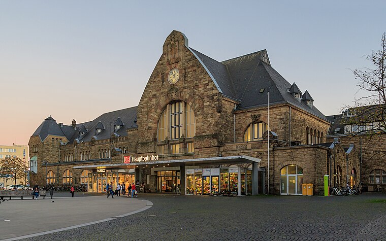 Aachen Hauptbahnhof is the most important railway station for the city of Aachen, in the far west of Germany near the Dutch and Belgian border. It is the largest of the four currently active Aachen stations, and is integrated into the long-distance network. Aachen Hauptbahnhof is situated 1¼ km northwest of Gartenkolonie Am Höfling.
Catholic University of Applied Sciences
University

Photo: KathoNRW, CC BY-SA 4.0.
Catholic University of Applied Sciences is situated 670 metres southwest of Gartenkolonie Am Höfling.
Places in the Area
Nearby places include Burtscheid and Forst.
Burtscheid
Suburb

Photo: ArthurMcGill, CC BY-SA 4.0.
Burtscheid is a district of the city of Aachen, part of the Aachen-Mitte Stadtbezirk. It is a health resort.


Gartenkolonie Am Höfling
- Type: Allotment garden
- Address: Branderhofer Weg 48, Aachen, 52066
- Location: Aachen, Aachen, Cologne District, Eifel, North Rhine-Westphalia, Germany, Central Europe, Europe
- View on OpenStreetMap
Latitude
50.75986° or 50° 45′ 36″ northLongitude
6.10306° or 6° 6′ 11″ eastOpen location code
9F28Q453+W6OpenStreetMap ID
way 117518516OpenStreetMap feature
landuse=allotments
This page is based on OpenStreetMap, Wikidata, and Wikimedia Commons.
We’d love your help improving our open data sources. Thank you for contributing.
Satellite Map
Discover Gartenkolonie Am Höfling from above in high-definition satellite imagery.
Places with the Same Name
Discover other places named “Gartenkolonie Am Höfling”.
Notable Places Nearby
Highlights include Bauhof and Am Branderhof 101.
Nearby Places
Explore places such as Rezeption, Toilette, Waschräume and Juttastraße.
Eifel: Must-Visit Destinations
Delve into Monschau, Herzogenrath, Zülpich, and Bad Münstereifel.
Curious Allotment Gardens to Discover
Uncover intriguing allotment gardens from every corner of the globe.
About Mapcarta. Data © OpenStreetMap contributors and available under the Open Database License". Text is available under the CC BY-SA 4.0 license, except for photos, directions, and the map. Photo: Knipptang, CC BY-SA 3.0.