Iglesia San Fracisco de Asís
Iglesia San Fracisco de Asís is a church in San José Province, Costa Rica which is located on Calle André Challe Penaforte. Iglesia San Fracisco de Asís is situated nearby to the community center Salón Comunal, as well as near the pitch Plaza Deportes Los Sitios.| Tap on a place to explore it |
- Type: Church
- Denomination: Catholic
- Address: Calle André Challe Penaforte, La Trinidad
Places of Interest Nearby
Highlights include Estadio Luis Ángel ‘Pipilo’ Umaña and Estadio Ricardo Saprissa Aymá.
Estadio Luis Ángel ‘Pipilo’ Umaña
Stadium

Photo: ElYolero6, CC BY-SA 4.0.
Estadio Luis Ángel ‘Pipilo’ Umaña is a stadium, which is situated 1½ km south of Iglesia San Fracisco de Asís.
Estadio Ricardo Saprissa Aymá
Stadium

Photo: Kevin959503, CC BY-SA 4.0.
Estadio Ricardo Saprissa Aymá is a football stadium in San Juan de Tibás, with a seating capacity of 23,112, making it the second-largest stadium in the country. Estadio Ricardo Saprissa Aymá is situated 4 km southwest of Iglesia San Fracisco de Asís.
Estadio Ecológico
Stadium
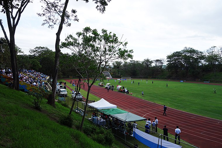
Photo: Wikimedia, CC BY-SA 3.0.
Estadio Ecológico is a stadium, which is situated 4 km south of Iglesia San Fracisco de Asís.
Places in the Area
Nearby places include San Vicente and Ipís.
San Vicente
Town

Photo: Wikimedia, CC BY-SA 3.0.
San Vicente is a district of the Moravia canton, that is located in the San José province of Costa Rica.
Ipís
Village
Ipís is a district of the Goicoechea canton, in the San José province of Costa Rica. Ipís is situated 3 km southeast of Iglesia San Fracisco de Asís.
San Juan District, Tibás
Town
San Juan is a district of the Tibás canton, in the San José province of Costa Rica. San Juan District, Tibás is situated 4½ km southwest of Iglesia San Fracisco de Asís.
Iglesia San Fracisco de Asís
- Categories: building, place of worship, and religion
- Location: San José Province, Costa Rica, Central America, North America
- View on OpenStreetMap
Latitude
9.97904° or 9° 58′ 45″ northLongitude
-84.04248° or 84° 2′ 33″ westOpen location code
66XQXXH5+J2OpenStreetMap ID
way 1175421856OpenStreetMap feature
amenity=place_of_worshipOpenStreetMap feature
building=yesOpenStreetMap attribute
denomination=catholic
This page is based on OpenStreetMap, Wikidata, and Wikimedia Commons.
We’d love your help improving our open data sources. Thank you for contributing.
Satellite Map
Discover Iglesia San Fracisco de Asís from above in high-definition satellite imagery.
Notable Places Nearby
Highlights include Salón Comunal and Plaza Deportes Los Sitios.
Nearby Places
Explore places such as CEN-CINAI and Parada Panadería Bryan.
Costa Rica: Must-Visit Destinations
Delve into San José, Alajuela, Puerto Limón, and Liberia.
Curious Churches to Discover
Uncover intriguing churches from every corner of the globe.
About Mapcarta. Data © OpenStreetMap contributors and available under the Open Database License". Text is available under the CC BY-SA 4.0 license, except for photos, directions, and the map. Photo: Andy Rusch, CC BY 2.0.