Thankful Community Park
Thankful Community Park is a park in Calhoun County, Alabama. Thankful Community Park is situated nearby to Washington Heights Baptist Church, as well as near Thankful Baptist Church.| Tap on a place to explore it |
Places of Interest Nearby
Highlights include United States Post Office and Anniston station.
United States Post Office
Courthouse

Photo: Spyder Monkey, CC BY-SA 3.0.
The U.S. Post Office, also known as the Federal Building and Courthouse, is a historic government building in Anniston, Alabama, United States. It was listed on the National Register of Historic Places on November 13, 1976. United States Post Office is situated 2 miles east of Thankful Community Park.
Anniston station
Railway station
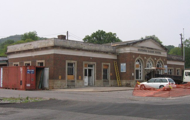
Photo: Oakshade, CC BY-SA 3.0.
Anniston station is an Amtrak train station at 126 West 4th Street in Anniston, Alabama. It is served by the Crescent passenger train. The station was originally designed by Milo R. Anniston station is situated 2½ miles southeast of Thankful Community Park.
Places in the Area
Nearby places include Anniston and Saks.
Anniston
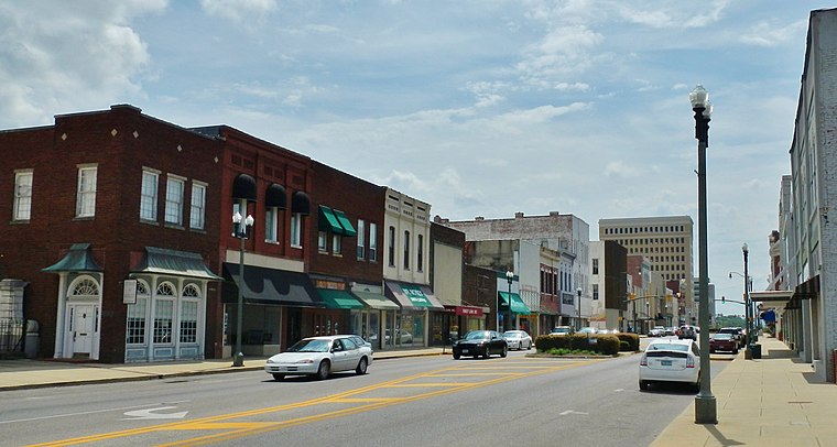
Photo: SaveRivers, CC BY-SA 3.0.
Anniston is a town of 22,000 people on the slope of the Blue Mountain in Alabama. It has several historic sites from the civil rights campaign of the 1960s.
Saks
Village
Saks is a census-designated place and Unincorporated community in Calhoun County, Alabama, United States. At the 2020 census, the population was 9,956. Saks is situated 3 miles northeast of Thankful Community Park.
Hobson City
Village
Hobson City is a town in Calhoun County, Alabama, United States. At the 2020 census, the population was 759. It is included in the Anniston-Oxford Metropolitan Statistical Area. Hobson City is situated 3 miles southeast of Thankful Community Park.
Thankful Community Park
- Type: Park
- Categories: school, recreation area, and historic site
- Location: Calhoun County, Alabama, South, United States, North America
- View on OpenStreetMap
Latitude
33.6642° or 33° 39′ 51″ northLongitude
-85.86732° or 85° 52′ 2″ westElevation
738 feet (225 metres)Open location code
865PM47M+M3OpenStreetMap ID
way 1176508009OpenStreetMap feature
historic=schoolOpenStreetMap feature
leisure=park
This page is based on OpenStreetMap, Wikidata, and Wikimedia Commons.
We’d love your help improving our open data sources. Thank you for contributing.
Satellite Map
Discover Thankful Community Park from above in high-definition satellite imagery.
Notable Places Nearby
Highlights include Washington Heights Baptist Church and Thankful Baptist Church.
Nearby Places
Explore places such as Randolph Park Elementary School and Bae Systems.
Alabama: Must-Visit Destinations
Delve into Montgomery, Birmingham, Mobile, and Huntsville.
Curious Parks to Discover
Uncover intriguing parks from every corner of the globe.
About Mapcarta. Data © OpenStreetMap contributors and available under the Open Database License". Text is available under the CC BY-SA 4.0 license, except for photos, directions, and the map. Photo: Latics, CC BY-SA 2.0.