Barbentane - La Fontaine
Barbentane - La Fontaine is a shelter in Barbentane, Arrondissement of Arles, Provence-Alpes-Côte d’Azur. Barbentane - La Fontaine is situated nearby to the sports venue Stade du Bosquet, as well as near the town hall Mairie de Barbentane.| Tap on a place to explore it |
Places of Interest Nearby
Highlights include Chateau de Barbentane and Maison des Chevaliers.
Chateau de Barbentane
Castle

Photo: Wikimedia, Public domain.
Chateau de Barbentane is a castle, which is situated 420 metres east of Barbentane - La Fontaine.
Maison des Chevaliers
Historic building

Photo: Telperion, CC BY-SA 3.0.
Maison des Chevaliers is a historic building, which is situated 430 metres east of Barbentane - La Fontaine.
Église Notre-Dame-de-Grâce de Barbentane
Church

Photo: Telperion, CC BY-SA 3.0.
Église Notre-Dame-de-Grâce de Barbentane is a church, which is situated 470 metres east of Barbentane - La Fontaine.
Places in the Area
Nearby places include Rognonas and Graveson.
Rognonas
Village
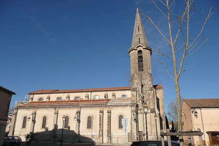
Photo: Wikimedia, CC BY-SA 3.0.
Rognonas is a commune in the Bouches-du-Rhône department in southern France. Rognonas is situated 5 km east of Barbentane - La Fontaine.
Graveson
Village

Photo: Wikimedia, CC BY-SA 3.0.
Graveson is a commune in the Bouches-du-Rhône department in southern France. Graveson is situated 6 km southeast of Barbentane - La Fontaine.
Ile Piot
Locality

Photo: Txllxt TxllxT, CC BY-SA 4.0.
Ile Piot is a locality, which is situated 7 km northeast of Barbentane - La Fontaine.
Barbentane - La Fontaine
Latitude
43.89961° or 43° 53′ 59″ northLongitude
4.74227° or 4° 44′ 32″ eastOpen location code
8FM6VPXR+RWOpenStreetMap ID
way 1178168173OpenStreetMap feature
amenity=shelter
This page is based on OpenStreetMap, Wikidata, and Wikimedia Commons.
We’d love your help improving our open data sources. Thank you for contributing.
Satellite Map
Discover Barbentane - La Fontaine from above in high-definition satellite imagery.
Notable Places Nearby
Highlights include Stade du Bosquet and Mairie de Barbentane.
Nearby Places
Explore places such as Barbentane - La Fontaine and Moulin de Bretoule.
Bouches-du-Rhône: Must-Visit Destinations
Delve into Marseille, Aix-en-Provence, Arles, and Salon-de-Provence.
Curious Shelters to Discover
Uncover intriguing shelters from every corner of the globe.
About Mapcarta. Data © OpenStreetMap contributors and available under the Open Database License". Text is available under the CC BY-SA 4.0 license, except for photos, directions, and the map. Photo: Benh, CC BY-SA 3.0.