Perkins Trails
Perkins Trails is a residential area in Austin, Travis, Texas. Perkins Trails is situated nearby to Capitol City Baptist Church, as well as near Austin Community College: South Austin Campus.| Tap on a place to explore it |
Places of Interest Nearby
Highlights include Crockett High School and South Congress Transit Center.
Crockett High School
School

Photo: WhisperToMe, Public domain.
David Crockett Early College High School is a public high school located in South Austin, Texas. The school opened in 1968 and is part of the Austin Independent School District. It was named after U.S. frontiersman Davy Crockett. Crockett High School is situated 3,700 feet southwest of Perkins Trails.
South Congress Transit Center
Bus station
South Congress Transit Center is a Capital Metropolitan Transportation Authority bus station in Austin, Texas. It is located off of Radam Lane on the south side of Ben White Boulevard, just west of South Congress Avenue in the SoCo area of Austin, Texas. South Congress Transit Center is situated 1¼ miles east of Perkins Trails.
Ann Richards School for Young Women Leaders
School
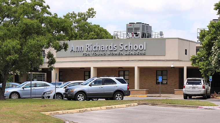 The Ann Richards School for Young Women Leaders is an all-girls college preparatory public school of choice for students in grades 6–12 located in Austin, Texas. Ann Richards School for Young Women Leaders is situated 1¼ miles north of Perkins Trails.
Places in the Area
Nearby places include Sunset Valley and South Austin.
Sunset Valley
Village

Photo: WhisperToMe, Public domain.
Sunset Valley is a city in Travis County, Texas, United States. The population was 683 at the time of the 2020 census. An enclave, it is surrounded on all sides by the city of Austin. Sunset Valley is situated 1½ miles west of Perkins Trails.
South Austin
 South Austin can refer to any part of Austin, Texas south of Lady Bird Lake and the downtown area, although many people use it to specifically refer to the south-central area directly south of downtown in the 78704 zip code.
South Congress
Neighborhood

Photo: Justin Jensen, CC BY 2.0.
South Congress is a neighborhood located on South Congress Avenue in Austin, Texas known as a shopping and cultural district with many eclectic small retailers, restaurants, music and art venues and, more recently, food trucks. South Congress is situated 2½ miles northeast of Perkins Trails.
Perkins Trails
- Type: Residential area
- Location: Austin, Travis, Texas, United States, North America
- View on OpenStreetMap
Latitude
30.21831° or 30° 13′ 6″ northLongitude
-97.7873° or 97° 47′ 14″ westOpen location code
86246697+83OpenStreetMap ID
way 1178594898OpenStreetMap feature
landuse=residential
This page is based on OpenStreetMap, Wikidata, and Wikimedia Commons.
We’d love your help improving our open data sources. Thank you for contributing.
Satellite Map
Discover Perkins Trails from above in high-definition satellite imagery.
Notable Places Nearby
Highlights include Capitol City Baptist Church and Austin Community College: South Austin Campus.
Nearby Places
Explore places such as Glenwood Square and Salem Walk Substation.
Austin: Must-Visit Destinations
Delve into South Austin, Northwest Austin, Downtown Austin, and East Austin.
Curious Residential Areas to Discover
Uncover intriguing residential areas from every corner of the globe.
About Mapcarta. Data © OpenStreetMap contributors and available under the Open Database License". Text is available under the CC BY-SA 4.0 license, except for photos, directions, and the map. Photo: boltron, CC BY-SA 2.0.