Kontiorannan koulu
Kontiorannan koulu is a school in Kontiolahti, Joensuu, North Karelia which is located on Jääkärintie. Kontiorannan koulu is situated nearby to the suburb Kontioniemi, as well as near Toivolan lottakioski.| Tap on a place to explore it |
Places of Interest Nearby
Highlights include Kontiolahti railway station and Kontiolahti biathlon stadium.
Kontiolahti railway station
Railway station

Photo: Junafani, CC BY-SA 3.0.
Kontiolahti railway station is situated 2 km southeast of Kontiorannan koulu.
Kontiolahti biathlon stadium
Sports venue

Photo: Guillaume Baviere, CC BY-SA 2.0.
Kontiolahti biathlon stadium is a sports venue, which is situated 2 km south of Kontiorannan koulu.
Kontiolahti Church
Church
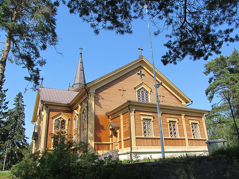
Photo: Annelis, CC BY-SA 3.0.
Kontiolahti Church is situated 3½ km northeast of Kontiorannan koulu.
Places in the Area
Nearby places include Kontioniemi and Paihola.

Paihola
Village

Photo: Miikka Väänänen, CC BY-SA 4.0.
Paihola is a village, which is situated 8 km southeast of Kontiorannan koulu.
Kontiorannan koulu
- Type: School
- Address: Jääkärintie 2, Kontioranta, 80790
- Category: education
- Location: Kontiolahti, Joensuu, North Karelia, Finnish Lakeland, Finland, Nordic countries, Europe
- View on OpenStreetMap
Latitude
62.73934° or 62° 44′ 22″ northLongitude
29.82273° or 29° 49′ 22″ eastOpen location code
9GJFPRQF+P3OpenStreetMap ID
way 1185231638OpenStreetMap feature
amenity=school
This page is based on OpenStreetMap, Wikidata, and Wikimedia Commons.
We’d love your help improving our open data sources. Thank you for contributing.
Satellite Map
Discover Kontiorannan koulu from above in high-definition satellite imagery.
Notable Places Nearby
Highlights include Toivolan lottakioski and Lähipelialue.
Nearby Places
Explore places such as Kontioniementie 34 E and Jääkärintie E.
North Karelia: Must-Visit Destinations
Delve into Joensuu, Kitee, Lieksa, and Outokumpu.
Curious Schools to Discover
Uncover intriguing schools from every corner of the globe.
About Mapcarta. Data © OpenStreetMap contributors and available under the Open Database License". Text is available under the CC BY-SA 4.0 license, except for photos, directions, and the map. Photo: Puolitosi, CC BY-SA 3.0.