Laurel Bank Estates
Laurel Bank Estates is a residential area in Blount, Tennessee. Laurel Bank Estates is situated nearby to Laurel Bank Baptist Church, as well as near William Blount High School.| Tap on a place to explore it |
Places of Interest Nearby
Highlights include William Blount High School.
William Blount High School
School
William Blount High School is a four-year public American high school located approximately 4.6 miles from Maryville in Blount County, Tennessee. Established in 1979 and named for Tennessee's territorial governor, WBHS is the largest of four high schools in the Blount County Schools public school district. William Blount High School is situated 1,700 feet southwest of Laurel Bank Estates.
Places in the Area
Nearby places include Old Glory and Armona.
Old Glory
Hamlet
Old Glory is an unincorporated community in Blount County, in the U.S. state of Tennessee. Old Glory is situated 2½ miles north of Laurel Bank Estates.
Armona
Hamlet
Armona is an unincorporated community in Blount County, Tennessee, in the United States. The origin of the name Armona is uncertain, but it may refer to a type of strawberry. Armona is situated 3 miles north of Laurel Bank Estates.
Maryville
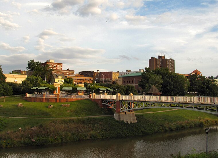 Maryville is a city in and the county seat of Blount County, Tennessee. Its population was 31,907 at the 2020 census.
Laurel Bank Estates
- Type: Residential area
- Location: Blount, Tennessee, South, United States, North America
- View on OpenStreetMap
Latitude
35.7433° or 35° 44′ 36″ northLongitude
-84.02965° or 84° 1′ 47″ westOpen location code
867QPXVC+84OpenStreetMap ID
way 1188378266OpenStreetMap feature
landuse=residential
This page is based on OpenStreetMap, Wikidata, and Wikimedia Commons.
We’d love your help improving our open data sources. Thank you for contributing.
Satellite Map
Discover Laurel Bank Estates from above in high-definition satellite imagery.
Places with the Same Name
Discover other places named “Laurel Bank Estates”.
Notable Places Nearby
Highlights include Laurel Bank Baptist Church and Praise Lutheran Church.
Nearby Places
Explore places such as William Blount Ninth Grade Academy and Seven Oaks.
Tennessee: Must-Visit Destinations
Delve into Nashville, Memphis, Knoxville, and Chattanooga.
Curious Residential Areas to Discover
Uncover intriguing residential areas from every corner of the globe.
About Mapcarta. Data © OpenStreetMap contributors and available under the Open Database License". Text is available under the CC BY-SA 4.0 license, except for photos, directions, and the map. Photo: Wikimedia, CC0.