Stadtwildnis
Stadtwildnis is a forest in Floridsdorf, Vienna. Stadtwildnis is situated nearby to the suburb Jedlesee, as well as near the neighborhood Denglerschanze.| Tap on a place to explore it |
Places of Interest
Highlights include Wien Floridsdorf railway station and Donauturm.
Wien Floridsdorf railway station
Railway station
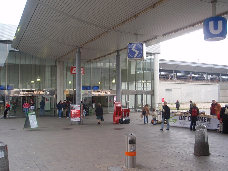
Photo: My Friend, CC BY-SA 3.0.
Wien Floridsdorf is a railway station located in the Floridsdorf district of Vienna, Austria. Opened in 1961, it is owned and operated by the Austrian Federal Railways, and is served by both regional and S-Bahn trains.
Donauturm

Photo: BambooBeast, CC BY-SA 3.0.
The Donauturm is a tower located in the Donaupark, Vienna, Austria. Opened in April 1964, it is the tallest structure in Austria, standing at 252 meters, and ranks as the 61st tallest tower in the world.
Vienna Islamic Centre
Mosque

Photo: Bwag, CC BY-SA 4.0.
The Vienna Islamic Centre is the largest mosque in Austria, located in Vienna's 21st district Floridsdorf.
Places in the Area
Nearby places include Outer East and Alsergrund.
Outer East

Photo: D.W., Public domain.
Outer East describes the Vienna districts Floridsdorf and Donaustadt.
Alsergrund

Photo: Gryffindor, CC BY-SA 3.0.
Alsergrund is the 9th district of Vienna. Alsergrund is an affluent suburb that includes much of the University of Vienna, several cozy business districts, and several hospitals.
Inner East

Photo: Wikimedia, CC BY-SA 3.0.
Vienna's Inner East is an artificial island formed between the river and the Donaukanal. The island contains large expanses of parks and forests, including the famous Prater park with the permanent funfair including the Riesenrad Ferris wheel.
Stadtwildnis
- Type: Forest
- Location: Floridsdorf, Vienna, Austria, Central Europe, Europe
- View on OpenStreetMap
Latitude
48.2708° or 48° 16′ 15″ northLongitude
16.3901° or 16° 23′ 24″ eastOpen location code
8FWR79CR+82OpenStreetMap ID
way 1204253669OpenStreetMap feature
landuse=forest
This page is based on OpenStreetMap, Wikidata, and Wikimedia Commons.
We’d love your help improving our open data sources. Thank you for contributing.
Satellite Map
Discover Stadtwildnis from above in high-definition satellite imagery.
Places with the Same Name
Discover other places named “Stadtwildnis”.
Localities in the Area
Explore places such as Jedlesee and Denglerschanze.
Notable Places Nearby
Highlights include Wilhelm Haibl Park and SOS Kinderdorf.
Vienna: Must-Visit Destinations
Delve into Innere Stadt, Vienna International Airport, Inner East, and Hietzing.
Curious Forests to Discover
Uncover intriguing forests from every corner of the globe.
About Mapcarta. Data © OpenStreetMap contributors and available under the Open Database License". Text is available under the CC BY-SA 4.0 license, except for photos, directions, and the map. Photo: Jebulon, CC0.