Christian-Rohlfs-Realschule
Christian-Rohlfs-Realschule is a school in Soest, Arnsberg, North Rhine-Westphalia which is located on Paradieser Weg. Christian-Rohlfs-Realschule is situated nearby to the public building Finanzamt Soest, as well as near the church Heiligkreuzkirche.| Tap on a place to explore it |
Places of Interest Nearby
Highlights include Pilgrim Haus and Soest station.
Pilgrim Haus
Hotel
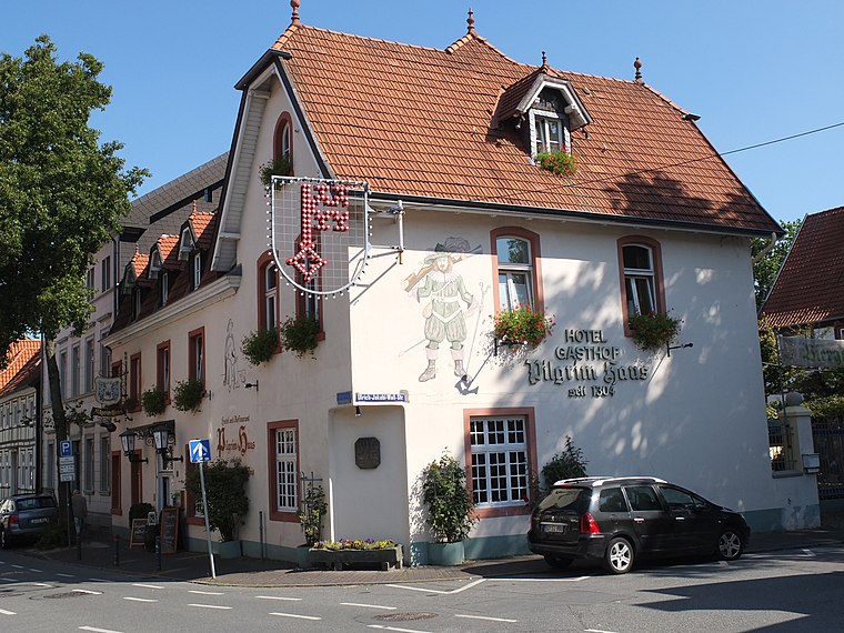
Photo: K.bierkaemper, CC BY-SA 3.0.
Pilgrim House is a traditional hotel and restaurant in Soest city, North Rhine-Westphalia, Germany. It was founded in 1304 and used mainly by pilgrims on Camino de Santiago. Pilgrim Haus is situated 710 metres southeast of Christian-Rohlfs-Realschule.
Soest station
Railway station

Photo: Stefan Flöper, CC BY-SA 4.0.
Soest station is a passenger station in the city of Soest in the German state of North Rhine-Westphalia. It is on the Hamm–Warburg and the Dortmund–Soest lines. It was also served by passenger trains on the Möhne Valley Railway from 1899 to 1960. Soest station is situated 1 km northeast of Christian-Rohlfs-Realschule.
Wilhelm-Morgner-Haus
Museum

Photo: Wikimedia, CC BY-SA 3.0 de.
Wilhelm-Morgner-Haus is a museum, which is situated 1 km east of Christian-Rohlfs-Realschule.
Places in the Area
Nearby places include Meckingsen and Ruploh.
Meckingsen
Village

Photo: Wikimedia, CC BY-SA 3.0.
Meckingsen is a village, which is situated 3½ km northwest of Christian-Rohlfs-Realschule.
Ruploh
Hamlet

Photo: Teta pk, CC BY-SA 3.0.
Ruploh is a hamlet, which is situated 3½ km south of Christian-Rohlfs-Realschule.
Deiringsen
Village

Photo: Wikimedia, CC BY-SA 3.0.
Deiringsen is a village, which is situated 4 km south of Christian-Rohlfs-Realschule.
Christian-Rohlfs-Realschule
- Type: School
- Address: Paradieser Weg 20, Soest, 59494
- Category: education
- Location: Soest, Soest, Arnsberg, South Westphalia, North Rhine-Westphalia, Germany, Central Europe, Europe
- View on OpenStreetMap
Latitude
51.57162° or 51° 34′ 18″ northLongitude
8.09316° or 8° 5′ 35″ eastOpen location code
9F3CH3CV+J7OpenStreetMap ID
way 1204846590OpenStreetMap feature
amenity=schoolOpenStreetMap feature
landuse=education
This page is based on OpenStreetMap, Wikidata, and Wikimedia Commons.
We’d love your help improving our open data sources. Thank you for contributing.
Satellite Map
Discover Christian-Rohlfs-Realschule from above in high-definition satellite imagery.
Notable Places Nearby
Highlights include Gymnastikhalle der Christian-Rohlfs-Realschule and Sporthalle der Christian-Rohlfs-Realschule.
Nearby Places
Explore places such as Pagenstraße and Tankink.
South Westphalia: Must-Visit Destinations
Delve into Siegen, Iserlohn, Lüdenscheid, and Schmallenberg.
Curious Schools to Discover
Uncover intriguing schools from every corner of the globe.
About Mapcarta. Data © OpenStreetMap contributors and available under the Open Database License". Text is available under the CC BY-SA 4.0 license, except for photos, directions, and the map. Photo: Wikimedia, CC0.