Öngulstorg
Öngulstorg is in Capital Region, Iceland. Öngulstorg is situated nearby to Vörputorg, as well as near the marina Snarfarahöfn.| Tap on a place to explore it |
Places of Interest Nearby
Highlights include Menntaskólinn við Sund and Langholtskirkja.
Menntaskólinn við Sund
College
Menntaskólinn við Sund is a secondary school in Reykjavík founded in 1969. At the time, there were only 4 other such schools in Iceland. Menntaskólinn við Sund is situated 1 km southwest of Öngulstorg.
Langholtskirkja
Church

Photo: Tommy Bee, Public domain.
Langholtskirkja is a church, which is situated 710 metres west of Öngulstorg.
Kleppur
Hospital
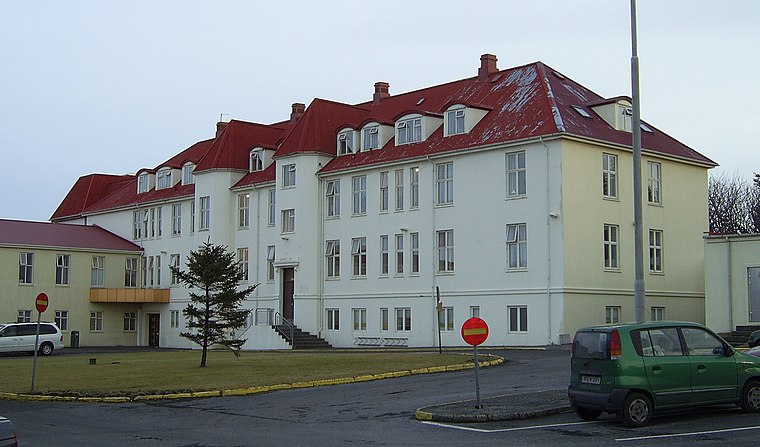
Photo: Gdh, CC BY-SA 3.0.
Kleppur or Kleppsspítali is an Icelandic psychiatric hospital that is operated by The National University Hospital of Iceland. The first laws concerning Kleppur were nr. Kleppur is situated 1¼ km north of Öngulstorg.
Places in the Area
Nearby places include Kópavogur and Reykjavík.
Kópavogur

Photo: Axel Kristinsson, CC BY 2.0.
Kópavogur is a town in Iceland that is the country's second-largest municipality by population. It lies immediately south of Reykjavík and is part of the Capital Region.
Reykjavík

Photo: Napoleon tnt, CC BY-SA 3.0.
Reykjavík is the capital of and largest city in Iceland and with an urban area population of around 233,000, it is the home to two-thirds of Iceland's population.
Garðabaer
Town

Photo: Wikimedia, Public domain.
Garðabær is a town and municipality in the Capital Region of Iceland. Garðabaer is situated 6 km southwest of Öngulstorg.
Öngulstorg
- Type: Construction
- Location: Capital Region, Iceland, Nordic countries, Europe
- View on OpenStreetMap
Latitude
64.13402° or 64° 8′ 3″ northLongitude
-21.84364° or 21° 50′ 37″ westOpen location code
99PW45M4+JGOpenStreetMap ID
way 1207147586OpenStreetMap feature
landuse=construction
This page is based on OpenStreetMap, Wikidata, and Wikimedia Commons.
We’d love your help improving our open data sources. Thank you for contributing.
Satellite Map
Discover Öngulstorg from above in high-definition satellite imagery.
Notable Places Nearby
Highlights include Vörputorg and Snarfarahöfn.
Nearby Places
Explore places such as COVIDTEST.is and Republik.
Iceland: Must-Visit Destinations
Delve into Reykjavík, Akureyri, Kópavogur, and Hafnarfjörður.
Curious Places to Discover
Uncover intriguing places from every corner of the globe.
About Mapcarta. Data © OpenStreetMap contributors and available under the Open Database License". Text is available under the CC BY-SA 4.0 license, except for photos, directions, and the map. Photo: Simisa, CC BY-SA 3.0.