Freiwillige Feuerwehr Gesees
Freiwillige Feuerwehr Gesees is a fire station in Gesees, Bayreuth, Bavaria which is located on Hauptstraße. Freiwillige Feuerwehr Gesees is situated nearby to the pitch SV Gesees, as well as near the protected area Schachblumenwiese bei Gesees.| Tap on a place to explore it |
Places of Interest Nearby
Highlights include St. Marien (Gesees) and Sophienberg.
St. Marien (Gesees)
Church

Photo: Powerbiker1, CC BY-SA 3.0.
St. Marien (Gesees) is a church, which is situated 530 metres south of Freiwillige Feuerwehr Gesees.

Sophienberg Castle
Castle

Photo: Gerosm, CC BY-SA 4.0.
Sophienberg Castle is situated 2 km southeast of Freiwillige Feuerwehr Gesees.
Places in the Area
Nearby places include Forkendorf and Saas.


Mistelbach
Village
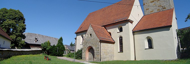
Photo: Bayreuth2009, CC BY 3.0.
Mistelbach is a municipality in the district of Bayreuth in Upper Franconia in Bavaria, Germany.
Freiwillige Feuerwehr Gesees
- Type: Fire station
- Address: Hauptstraße 42, Gesees, 95494
- Category: building
- Location: Gesees, Bayreuth, Upper Franconia, Franconia, Bavaria, Germany, Central Europe, Europe
- View on OpenStreetMap
Latitude
49.90352° or 49° 54′ 13″ northLongitude
11.54366° or 11° 32′ 37″ eastOpen location code
8FXHWG3V+CFOpenStreetMap ID
way 1208169000OpenStreetMap feature
amenity=fire_stationOpenStreetMap feature
building=fire_station
This page is based on OpenStreetMap, Wikidata, and Wikimedia Commons.
We’d love your help improving our open data sources. Thank you for contributing.
Satellite Map
Discover Freiwillige Feuerwehr Gesees from above in high-definition satellite imagery.
Notable Places Nearby
Highlights include SV Gesees and Schachblumenwiese bei Gesees.
Nearby Places
Explore places such as Sportheim SV Gesees and Hertel Möbel e.K..
Upper Franconia: Must-Visit Destinations
Delve into Bamberg, Bayreuth, Coburg, and Hof.
Curious Fire Stations to Discover
Uncover intriguing fire stations from every corner of the globe.
About Mapcarta. Data © OpenStreetMap contributors and available under the Open Database License". Text is available under the CC BY-SA 4.0 license, except for photos, directions, and the map. Photo: Wikimedia, CC0.