Razvojni center v Radmožanci
Razvojni center v Radmožanci is a building in Lendava, Eastern Slovenia which is located on Radmožanci / Radamos. Razvojni center v Radmožanci is situated nearby to the fire station PGD Radmožanci, as well as near the village Banuta.| Tap on a place to explore it |
Places in the Area
Nearby places include Radmožanci and Banuta.
Radmožanci
Village

Photo: Wikimedia, Public domain.
Radmožanci is a settlement northwest of Lendava in the Prekmurje region of Slovenia.
Banuta
Village

Photo: CivertanS, CC BY-SA 4.0.
Banuta is a small settlement north of Lendava in the Prekmurje region of Slovenia.
Kamovci
Village
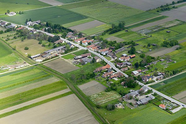
Photo: CivertanS, CC BY-SA 4.0.
Kamovci is a small village on the road from Dobrovnik to Lendava in the Prekmurje region of Slovenia, right on the border with Hungary.
Razvojni center v Radmožanci
- Type: Building
- Address: Radmožanci / Radamos 121, Dobrovnik, 9223
- Location: Lendava, Eastern Slovenia, Slovenia, Central Europe, Europe
- View on OpenStreetMap
Latitude
46.60704° or 46° 36′ 25″ northLongitude
16.38375° or 16° 23′ 2″ eastOpen location code
8FRRJ94M+RFOpenStreetMap ID
way 1210712082OpenStreetMap feature
building=yes
This page is based on OpenStreetMap, Wikidata, and Wikimedia Commons.
We’d love your help improving our open data sources. Thank you for contributing.
Satellite Map
Discover Razvojni center v Radmožanci from above in high-definition satellite imagery.
Notable Places Nearby
Highlights include PGD Radmožanci and Kapelica sv. Marije v Čornon logi.
Nearby Places
Explore places such as Radmožanci and Božje znamenje.
Eastern Slovenia: Must-Visit Destinations
Delve into Maribor, Ptuj, Murska Sobota, and Goričko Landscape Park.
Curious Buildings to Discover
Uncover intriguing buildings from every corner of the globe.
About Mapcarta. Data © OpenStreetMap contributors and available under the Open Database License". Text is available under the CC BY-SA 4.0 license, except for photos, directions, and the map. Photo: Ljuba brank, CC BY-SA 4.0.