Calvary Evangelical Free Church
Calvary Evangelical Free Church is a church in Borough of Roseland, Essex County, New Jersey. Calvary Evangelical Free Church is situated nearby to the pitch Harrison Field, as well as near Michael Colitti Multipurpose Court.| Tap on a place to explore it |
Places of Interest Nearby
Highlights include Grover Cleveland Park and Caldwell College.
Grover Cleveland Park
Park
Grover Cleveland Park, the seventh-largest park in the Essex County, New Jersey, USA, county-park system, is a heavily wooded park covering 41.48 acres of waterways, including Pine Brook Creek, which runs through the park feeding a small pond at the lower end.
Caldwell College
University
Caldwell University is a private Catholic university in Caldwell, New Jersey, United States. Founded in 1939 by the Sisters of St. Dominic, the university is accredited by the Middle States Commission on Higher Education, chartered by the State of New Jersey, and registered with the Regents of the University of the State of New York. Caldwell College is situated 1¼ miles northeast of Calvary Evangelical Free Church.
Grover Cleveland Birthplace
Park

Photo: Wikimedia, Public domain.
The Grover Cleveland Birthplace is a historic site located at 207 Bloomfield Avenue in Caldwell, Essex County, New Jersey, United States. It is the only house museum dedicated to U.S. President Grover Cleveland. Grover Cleveland Birthplace is situated 1¼ miles northeast of Calvary Evangelical Free Church.
Places in the Area
Nearby places include Essex Fells and Roseland.
Essex Fells
Village
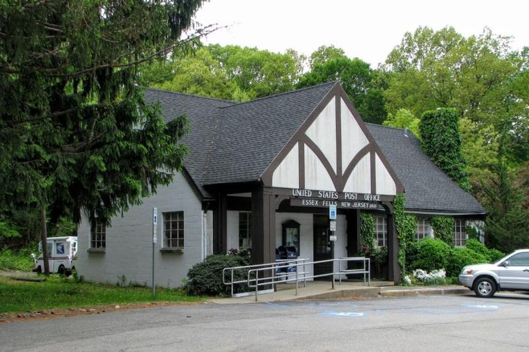
Photo: NAB1997, CC BY-SA 4.0.
Essex Fells is a borough in Essex County, in the U.S. state of New Jersey. As of the 2020 United States census, the borough's population was 2,244, an increase of 131 from the 2010 census count of 2,113, which in turn had reflected a decline of 49 from the 2,162 counted in the 2000 census.
Roseland
Village
Photo: Jag9889, CC BY-SA 4.0.
Roseland is a borough in western Essex County, in the U.S. state of New Jersey. As of the 2020 United States census, the borough's population was 6,299, an increase of 480 from the 2010 census count of 5,819, which in turn reflected an increase of 521 from the 5,298 counted in the 2000 census.
Caldwell
Village

Photo: Jared Kofsky, CC BY-SA 3.0.
Caldwell is a borough located in northwestern Essex County, in the U.S. state of New Jersey, about 16 miles west of New York City and 6 miles north-west of Newark, the state's most populous city.
Calvary Evangelical Free Church
- Type: Church
- Categories: building and religion
- Location: Borough of Roseland, Essex County, Gateway, New Jersey, Mid-Atlantic, United States, North America
- View on OpenStreetMap
Latitude
40.82296° or 40° 49′ 23″ northLongitude
-74.28854° or 74° 17′ 19″ westOpen location code
87G7RPF6+5HOpenStreetMap ID
way 1211355444OpenStreetMap feature
building=church
This page is based on OpenStreetMap, Wikidata, and Wikimedia Commons.
We’d love your help improving our open data sources. Thank you for contributing.
Satellite Map
Discover Calvary Evangelical Free Church from above in high-definition satellite imagery.
Places with the Same Name
Discover other places named “Calvary Evangelical Free Church”.
Notable Places Nearby
Highlights include Harrison Field and Michael Colitti Multipurpose Court.
Nearby Places
Explore places such as Shell and Fairchilds Market.
Essex County: Must-Visit Destinations
Delve into Newark, Newark Liberty International Airport, Montclair, and Maplewood.
Curious Churches to Discover
Uncover intriguing churches from every corner of the globe.
About Mapcarta. Data © OpenStreetMap contributors and available under the Open Database License". Text is available under the CC BY-SA 4.0 license, except for photos, directions, and the map. Photo: King of Hearts, CC BY-SA 3.0.