Estação Elevatória da Águas Residuais de Angeiras
Estação Elevatória da Águas Residuais de Angeiras is an industrial building in Portugal. Estação Elevatória da Águas Residuais de Angeiras is situated nearby to the beach Praia do Funtão, as well as near the cemetery Cemitério de Lavra.| Tap on a place to explore it |
Places of Interest Nearby
Highlights include Francisco de Sá Carneiro Airport and Castro de São Paio.
Francisco de Sá Carneiro Airport
Aerodrome

Photo: Kanakari, CC BY-SA 3.0.
Francisco Sá Carneiro Airport or simply Porto Airport is an international airport near Porto, Portugal. It is located 11 km northwest of the Clérigos Tower. Francisco de Sá Carneiro Airport is situated 4 km east of Estação Elevatória da Águas Residuais de Angeiras.
Castro de São Paio
Archaeological site

Photo: Vitor Oliveira, CC BY-SA 2.0.
Castro de São Paio is an archaeological site, which is situated 2½ km north of Estação Elevatória da Águas Residuais de Angeiras.
Modivas Sul metro station
Railway station
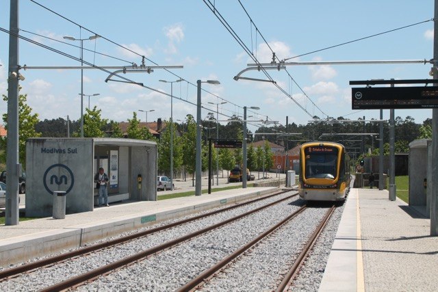
Photo: Ernstkers, CC BY-SA 4.0.
Modivas Sul metro station is a railway station, which is situated 4 km northeast of Estação Elevatória da Águas Residuais de Angeiras.
Places in the Area
Nearby places include Labruge and Vila Chã.
Labruge

Photo: Vitor Oliveira, CC BY-SA 2.0.
Labruge is a town in the Douro Litoral, Norte region of Portugal. It lies on the Portuguese Coastal Way trail of the Camino de Santiago. The parish has 3,000 inhabitants.
Vila Chã
Vila Chã is a town in the Douro Litoral, Norte region of Portugal. It lies on the Portuguese Coastal Way trail of the Camino de Santiago. The parish has 3,400 inhabitants.Perafita
Town
Perafita, Lavra e Santa Cruz do Bispo is a civil parish in the municipality of Matosinhos, Portugal. It was formed in 2013 by the merger of the former parishes Perafita, Lavra and Santa Cruz do Bispo. Perafita is situated 4½ km southeast of Estação Elevatória da Águas Residuais de Angeiras.
Estação Elevatória da Águas Residuais de Angeiras
- Type: Industrial building
- Roof shape: flat
- Categories: building, pumping station, and industry
- Location: Portugal, Iberia, Europe
- View on OpenStreetMap
Latitude
41.25846° or 41° 15′ 30″ northLongitude
-8.72301° or 8° 43′ 23″ westLevels
1Operator
Indaqua MatosinhosOpen location code
8CHH775G+9QOpenStreetMap ID
way 1213822233OpenStreetMap feature
building=industrialOpenStreetMap feature
man_made=pumping_stationOpenStreetMap attribute
roof-shape=flat
This page is based on OpenStreetMap, Wikidata, and Wikimedia Commons.
We’d love your help improving our open data sources. Thank you for contributing.
Satellite Map
Discover Estação Elevatória da Águas Residuais de Angeiras from above in high-definition satellite imagery.
Notable Places Nearby
Highlights include Praia do Funtão and Cemitério de Lavra.
Nearby Places
Explore places such as Praia do Funtão and Parque do Funtão.
Portugal: Must-Visit Destinations
Delve into Lisbon, Caldas da Rainha, Porto, and Coimbra.
Curious Industrial Buildings to Discover
Uncover intriguing industrial buildings from every corner of the globe.
About Mapcarta. Data © OpenStreetMap contributors and available under the Open Database License". Text is available under the CC BY-SA 4.0 license, except for photos, directions, and the map. Photo: Tsy1980, CC BY-SA 4.0.