Belus
Belus is a building in Schwalbach, Saarlouis, Saarland which is located on Gottlieb-Daimler-Straße. Belus is situated nearby to the cemetery Friedhof Hülzweiler, as well as near the sports venue Wellvita.| Tap on a place to explore it |
Places of Interest Nearby
Highlights include Saar Polygon and St. Martin (Schwalbach (Saar)).
Saar Polygon
Scenic viewpoint

Photo: Milseburg, CC BY-SA 4.0.
The Saar Polygon in Ensdorf, Saarland is a monument commemorating the coal mining industry in Saarland, which ended in June 2012. Saar Polygon is situated 2½ km west of Belus.
St. Martin (Schwalbach (Saar))
Church
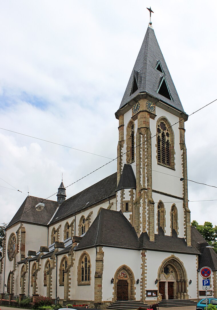
Photo: Mstp77, CC BY-SA 3.0.
St. Martin (Schwalbach (Saar)) is a church, which is situated 2½ km south of Belus.
St. Josef (Saarlouis)
Church

Photo: Matthwiki, CC BY-SA 3.0 de.
St. Josef (Saarlouis) is a church, which is situated 2½ km west of Belus.
Places in the Area
Nearby places include Schwalbach and Saarwellingen.
Schwalbach
Village
Photo: Mstp77, CC BY-SA 3.0.
Schwalbach is a municipality in the district of Saarlouis, in Saarland, Germany. It is situated approximately 5 km east of Saarlouis, and 15 km northwest of Saarbrücken. Schwalbach is situated 2½ km south of Belus.
Saarwellingen
Village
 Saarwellingen is a municipality in the district of Saarlouis in Saarland, Germany. As of 2022 it has a population of 13,302. Saarwellingen is situated 3 km north of Belus.
Ensdorf
Village

Photo: Lokilech, CC BY-SA 3.0.
Ensdorf is a municipality in the district of Saarlouis, in Saarland, Germany. It is on the right bank of the river Saar, opposite Saarlouis, approximately 20 km northwest of Saarbrücken. Ensdorf is situated 3½ km southwest of Belus.
Belus
- Type: Building
- Address: Gottlieb-Daimler-Straße 2, Schwalbach, 66773
- Location: Schwalbach, Saarlouis, Saarland, Germany, Central Europe, Europe
- View on OpenStreetMap
Latitude
49.32522° or 49° 19′ 31″ northLongitude
6.81459° or 6° 48′ 53″ eastOpen location code
8FX88RG7+3ROpenStreetMap ID
way 121900495OpenStreetMap feature
building=yes
This page is based on OpenStreetMap, Wikidata, and Wikimedia Commons.
We’d love your help improving our open data sources. Thank you for contributing.
Satellite Map
Discover Belus from above in high-definition satellite imagery.
Places with the Same Name
Discover other places named “Belus”.
Notable Places Nearby
Highlights include Friedhof Hülzweiler and Wellvita.
Nearby Places
Explore places such as SEW Eurodrive and Heckmann.
Saarland: Must-Visit Destinations
Delve into Saarbrücken, Saarlouis, Homburg, and Merzig.
Curious Buildings to Discover
Uncover intriguing buildings from every corner of the globe.
About Mapcarta. Data © OpenStreetMap contributors and available under the Open Database License". Text is available under the CC BY-SA 4.0 license, except for photos, directions, and the map. Photo: wolfgangstaudt, CC BY 2.0.