Port Vauban Heliport
Port Vauban Heliport is a helipad in Provence-Alpes-Côte d’Azur, France. Port Vauban Heliport is situated nearby to Yachtclub, as well as near the work of art Nomade.| Tap on a place to explore it |
Places of Interest Nearby
Highlights include Stade du Fort Carré and Musée Picasso.
Stade du Fort Carré
Sports venue
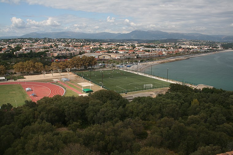
Photo: Plyd, Public domain.
Stade du Fort Carré is a multi-use stadium in Antibes, France, home ground of the FC Antibes, named after the neighboring Fort Carré. It is currently used mostly for football matches and the local athletics club. Stade du Fort Carré is situated 640 metres northwest of Port Vauban Heliport.
Musée Picasso
Museum

Photo: Olivier2000, CC BY-SA 1.0.
The Musée Picasso, formerly the Château Grimaldi at Antibes, is built upon the foundations of the ancient Greek town of Antipolis. Antibes is a resort town in the Alpes-Maritimes department in southeastern France, on the Mediterranean Sea. Musée Picasso is situated 1 km south of Port Vauban Heliport.
Antibes Railway Station
Railway station

Photo: Wikimedia, Public domain.
Antibes station is a railway station located in Antibes, Alpes-Maritimes, southern France. The station is located on the Marseille–Ventimiglia railway. The train services are operated by SNCF. Antibes Railway Station is situated 1 km west of Port Vauban Heliport.
Places in the Area
Nearby places include Antibes and Juan-les-Pins.
Antibes

Photo: David Baron, CC BY-SA 2.0.
Antibes is a city in the French Riviera. The Cap d'Antibes is the break between the Bay of Cannes to the south-west and the Baie des Anges to the north east.
Juan-les-Pins
Suburb

Photo: Ameilland, CC BY-SA 3.0.
Juan-les-Pins is a town in the commune of Antibes in the Alpes-Maritimes department in Southeastern France. Located on the French Riviera, it is situated between Nice and Cannes, 13 kilometres to the southwest of Nice Côte d'Azur Airport. Juan-les-Pins is situated 2½ km southwest of Port Vauban Heliport.
Cap d’Antibes
Suburb

Photo: Prouzet, CC BY-SA 3.0.
Cap d’Antibes is a suburb, which is situated 3½ km south of Port Vauban Heliport.
Port Vauban Heliport
- Type: Helipad
- Category: transportation
- Location: Provence-Alpes-Côte d’Azur, France, Europe
- View on OpenStreetMap
Latitude
43.5882° or 43° 35′ 18″ northLongitude
7.13233° or 7° 7′ 56″ eastOpen location code
8FM9H4QJ+7WOpenStreetMap ID
way 1222204534OpenStreetMap feature
aeroway=helipad
This page is based on OpenStreetMap, Wikidata, and Wikimedia Commons.
We’d love your help improving our open data sources. Thank you for contributing.
Satellite Map
Discover Port Vauban Heliport from above in high-definition satellite imagery.
Notable Places Nearby
Highlights include Yachtclub and Nomade.
Nearby Places
Explore places such as Quai des Milliardaires and Aurile.
Provence-Alpes-Côte d’Azur: Must-Visit Destinations
Delve into Marseille, Nice, Cannes, and Avignon.
Curious Helipads to Discover
Uncover intriguing helipads from every corner of the globe.
About Mapcarta. Data © OpenStreetMap contributors and available under the Open Database License". Text is available under the CC BY-SA 4.0 license, except for photos, directions, and the map. Photo: Inkey, CC BY 2.0.