Pöhlde railway station
Pöhlde railway station is a building in Herzberg am Harz, Göttingen, Lower Saxony which is located on Theodor-Heuss-Straße. Pöhlde railway station is situated nearby to the swimming area Eckerloch, Natur-Badeteich, as well as near the post office Deutsche Post.| Tap on a place to explore it |
- Type: Building
- Description: former railway station in Germany
- Also known as: “Pöhlde”
- Address: Theodor-Heuss-Straße 2, Pöhlde, Herzberg am Harz, 37412
Places of Interest Nearby
Highlights include Johannes-Servatius-Kirche and Wiedensee.
Johannes-Servatius-Kirche
Church
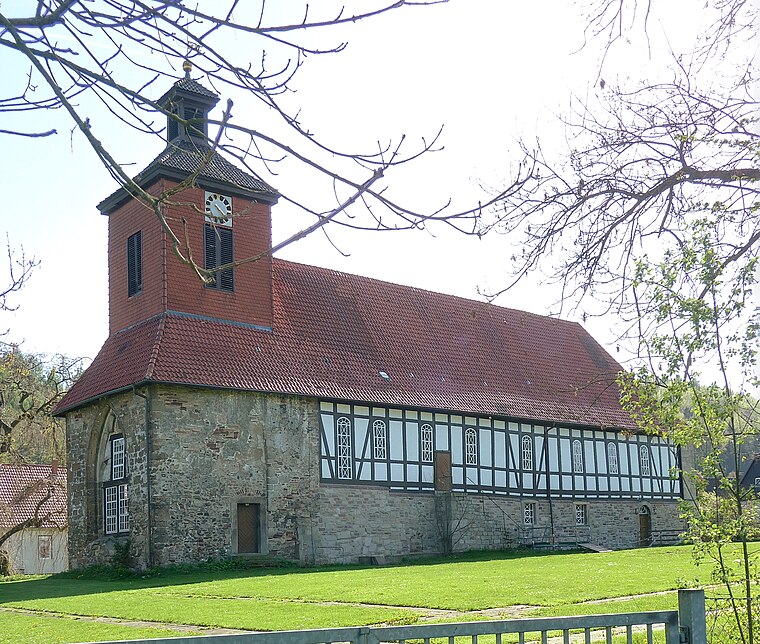
Photo: Dehio, CC BY-SA 3.0.
Johannes-Servatius-Kirche is a church, which is situated 1¼ km west of Pöhlde railway station.

Rhume Spring
Spring
The Rhume Spring is a large karst spring in the eastern part of the Rotenberg ridge not far from the northeastern edge of the village of Rhumspringe in the Harz mountains of Germany. It is the source of the River Rhume. Rhume Spring is situated 3 km southwest of Pöhlde railway station.
Places in the Area
Nearby places include Pöhlde and Scharzfeld.
Pöhlde
Village
Pöhlde is a village in southern Lower Saxony in Germany. It is part of the town Herzberg am Harz. It has a population of 2207. Archaeological excavation has revealed traces of settlement dating to the 2nd through 4th centuries AD.
Scharzfeld
Village

Photo: Kassandro, CC BY-SA 3.0.
Scharzfeld is a village in the borough of Herzberg am Harz in the district of Göttingen in South Lower Saxony, Germany. Scharzfeld lies at a height of about 220 m above sea level and has 1,765 inhabitants. Scharzfeld is situated 4 km northeast of Pöhlde railway station.
Rhumspringe
Village

Photo: Dehio, CC BY-SA 3.0.
Rhumspringe is a municipality in the district of Göttingen, in Lower Saxony, Germany. It is part of the Eichsfeld. The source of the river Rhume is at Rhume Spring in Rhumspringe. Rhumspringe is situated 4 km southwest of Pöhlde railway station.
Pöhlde railway station
- Category: railway station
- Location: Herzberg am Harz, Göttingen, Southern Lower Saxony, Lower Saxony, Germany, Central Europe, Europe
- View on OpenStreetMap
Latitude
51.61304° or 51° 36′ 47″ northLongitude
10.32652° or 10° 19′ 36″ eastOpen location code
9F3GJ87G+6JOpenStreetMap ID
way 1223172627OpenStreetMap feature
building=yesWikidata ID
Q109443812
This page is based on OpenStreetMap, Wikidata, and Wikimedia Commons.
We’d love your help improving our open data sources. Thank you for contributing.
Satellite Map
Discover Pöhlde railway station from above in high-definition satellite imagery.
In Other Languages
From Dutch to Venetian—“Pöhlde railway station” goes by many names.
- Dutch: “station Pöhlde”
- French: “gare de Pöhlde”
- French: “Gare de Pöhlde”
- German: “Bahnhof Pöhlde”
- Venetian: “stasion de Pöhlde”
Notable Places Nearby
Highlights include TC Pöhlde and Eckerloch, Natur-Badeteich.
Nearby Places
Explore places such as akkuteam and R&M Chemie GmbH.
Southern Lower Saxony: Must-Visit Destinations
Delve into Göttingen, Goslar, Hamelin, and Hann. Münden.
Curious Buildings to Discover
Uncover intriguing buildings from every corner of the globe.
About Mapcarta. Data © OpenStreetMap contributors and available under the Open Database License". Text is available under the CC BY-SA 4.0 license, except for photos, directions, and the map. Photo: Wikimedia, CC BY-SA 3.0.