Mapar
Mapar is a building in Redon, Ille-et-Vilaine, Brittany. Mapar is situated nearby to the cemetery Cimetière de Galerne, as well as near the community center Centre Social Confluence.| Tap on a place to explore it |
Places of Interest Nearby
Highlights include Redon station and Redon Agglomération.
Redon station
Railway station
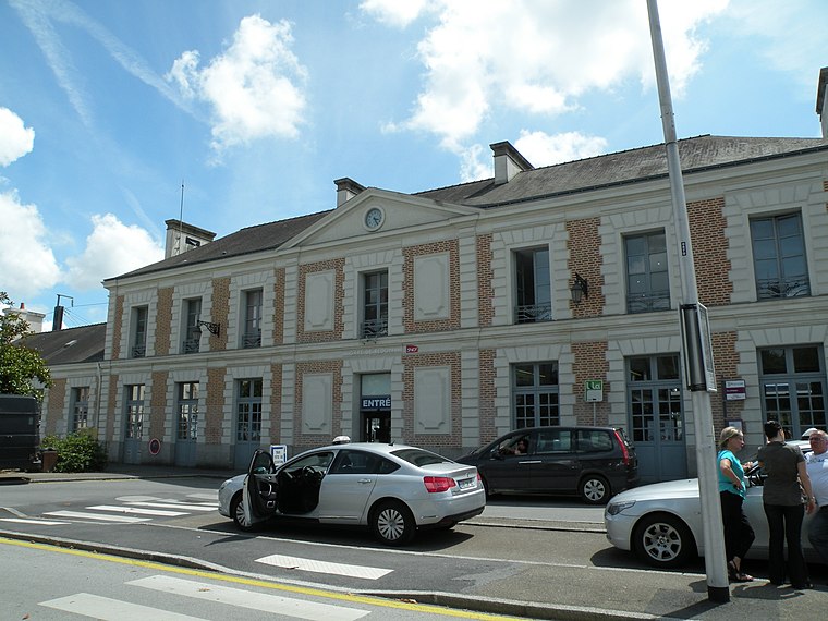
Photo: Pymouss44, CC BY-SA 3.0.
Redon is a railway station serving the town of Redon, Ille-et-Vilaine department, western France. The station is situated on the Rennes–Redon railway and the Savenay–Landerneau railway. Redon station is situated 690 metres southwest of Mapar.
Redon Agglomération
Government office
Redon Agglomération is a French intercommunal structure centred on the city of Redon. It is located in the departments Morbihan, Ille-et-Vilaine and Loire-Atlantique, in the regions Brittany and Pays de la Loire, northwestern France. Redon Agglomération is situated 1 km southwest of Mapar.
Église Saint-Charles de Redon
Church

Photo: Simon de l’Ouest, CC BY-SA 4.0.
Église Saint-Charles de Redon is a church, which is situated 520 metres northeast of Mapar.
Places in the Area
Nearby places include Sainte-Marie and Glénac.
Sainte-Marie
Village

Photo: Jinroh001, CC BY-SA 3.0.
Sainte-Marie is a commune in the Ille-et-Vilaine department in Brittany in northwestern France. Sainte-Marie is situated 7 km northeast of Mapar.
Glénac
Village

Photo: Futurhit12, CC BY-SA 4.0.
Glénac is a former commune in the Morbihan department of Brittany in north-western France. On 1 January 2017, it was merged into the commune La Gacilly. Its population was 908 in 2022. Inhabitants of Glénac are called in French Glénacois. Glénac is situated 9 km northwest of Mapar.
Mapar
- Type: Building
- Location: Redon, Arrondissement of Redon, Ille-et-Vilaine, Brittany, France, Europe
- View on OpenStreetMap
Latitude
47.65666° or 47° 39′ 24″ northLongitude
-2.08263° or 2° 4′ 58″ westOpen location code
8CVVMW48+MWOpenStreetMap ID
way 122532866OpenStreetMap feature
building=yes
This page is based on OpenStreetMap, Wikidata, and Wikimedia Commons.
We’d love your help improving our open data sources. Thank you for contributing.
Satellite Map
Discover Mapar from above in high-definition satellite imagery.
Places with the Same Name
Discover other places named “Mapar”.
Notable Places Nearby
Highlights include Cimetière de Galerne and Centre Social Confluence.
Nearby Places
Explore places such as CSAPA de Redon and CMP de Redon.
Brittany: Must-Visit Destinations
Delve into Rennes, Brest, Finistère, and Morbihan.
Curious Buildings to Discover
Uncover intriguing buildings from every corner of the globe.
About Mapcarta. Data © OpenStreetMap contributors and available under the Open Database License". Text is available under the CC BY-SA 4.0 license, except for photos, directions, and the map. Photo: Fab5669, CC BY-SA 4.0.