MJC des Ponts Jumeaux
MJC des Ponts Jumeaux is a pitch in Toulouse, Haute-Garonne, Occitanie. MJC des Ponts Jumeaux is situated nearby to the college Campus HEP Toulouse, as well as near the bridge Pont de l’Embouchure.| Tap on a place to explore it |
Places of Interest Nearby
Highlights include TBS Education and Port de l’Embouchure.
TBS Education
College
TBS Education, formerly Toulouse Business School and Groupe ESC Toulouse, is a triple crown business school founded in 1903 by the Toulouse Chamber of Commerce and Industry. TBS Education is situated 1½ km east of MJC des Ponts Jumeaux.
Port de l’Embouchure

Photo: Archaeodontosaurus, CC BY-SA 4.0.
The Port de l'Embouchure is one of the two ports located in Toulouse on the Canal du Midi. The other being the Port Saint-Sauveur. This port is located in the basin at the Ponts Jumeaux. Port de l’Embouchure is situated 270 metres northeast of MJC des Ponts Jumeaux.
Bas-relief des Ponts-Jumeaux
Work of art

Photo: Archaeodontosaurus, CC BY-SA 4.0.
Bas-relief des Ponts-Jumeaux is a work of art, which is situated 390 metres northeast of MJC des Ponts Jumeaux.
Places in the Area
Nearby places include Ponts Jumeaux and Toulouse Sept Deniers.
Ponts Jumeaux
Locality
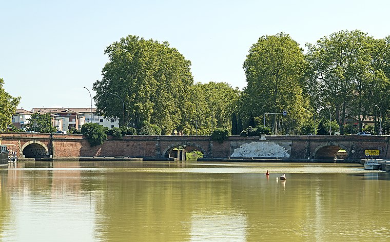
Photo: Archaeodontosaurus, CC BY-SA 3.0.
The Ponts Jumeaux is the point at which the Canal du Midi joins the Canal de Garonne and the River Garonne, via the Canal de Brienne. It was built in 1774 by Joseph-Marie de Saget, a civil engineer in the province of Languedoc in Toulouse.


MJC des Ponts Jumeaux
- Type: Pitch
- Categories: building, community center, public building, recreation area, and sports location
- Location: Toulouse, Arrondissement of Toulouse, Haute-Garonne, Occitanie, France, Europe
- View on OpenStreetMap
Latitude
43.60938° or 43° 36′ 34″ northLongitude
1.41432° or 1° 24′ 52″ eastOpen location code
8FM3JC57+QPOpenStreetMap ID
way 122978750OpenStreetMap feature
amenity=community_centreOpenStreetMap feature
building=publicOpenStreetMap feature
leisure=pitchOpenStreetMap feature
sport=multi
This page is based on OpenStreetMap, Wikidata, and Wikimedia Commons.
We’d love your help improving our open data sources. Thank you for contributing.
Satellite Map
Discover MJC des Ponts Jumeaux from above in high-definition satellite imagery.
Notable Places Nearby
Highlights include Campus HEP Toulouse and Pont de l’Embouchure.
Nearby Places
Explore places such as L’Oustal and Le Gros Arbre.
Haute-Garonne: Must-Visit Destinations
Delve into Boutx, Tarn, Roquesérière, and Pechbonnieu.
Curious Pitches to Discover
Uncover intriguing pitches from every corner of the globe.
About Mapcarta. Data © OpenStreetMap contributors and available under the Open Database License". Text is available under the CC BY-SA 4.0 license, except for photos, directions, and the map. Photo: PierreSelim, CC BY 3.0.