Subestação Fabricela
Subestação Fabricela is an electrical substation in Antuzede e Vil de Matos, Coimbra. Subestação Fabricela is situated nearby to the town Ançã, as well as near the village Vil de Matos.| Tap on a place to explore it |
Places of Interest Nearby
Highlights include Pelourinho de Ançã and Igreja Paroquial de Ançã.
Pelourinho de Ançã

Photo: VeronicaSGoncalves, CC BY-SA 4.0.
Pelourinho de Ançã is situated 1½ km northwest of Subestação Fabricela.
Igreja Paroquial de Ançã
Church

Photo: VeronicaSGoncalves, CC BY-SA 4.0.
Igreja Paroquial de Ançã is a church, which is situated 1½ km northwest of Subestação Fabricela.
Casa Nobre no Terreiro do Paço
Residential building

Photo: VeronicaSGoncalves, CC BY-SA 4.0.
Casa Nobre no Terreiro do Paço is a residential building, which is situated 1½ km northwest of Subestação Fabricela.
Places in the Area
Nearby places include Ançã and Vil de Matos.
Ançã
Town
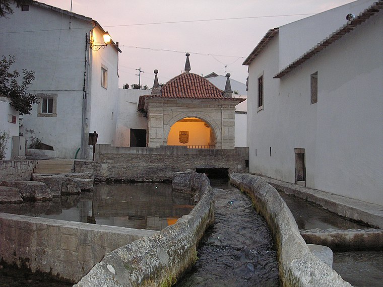
Photo: VeronicaSGoncalves, CC BY-SA 4.0.
Ançã is a Portuguese village and parish in the municipality of Cantanhede, with an area of 18.1 km2 and 2,625 inhabitants. It has a population density of 145 inhabitants / km².
Vil de Matos
Village
Vil de Matos is a former civil parish in the municipality of Coimbra, Portugal. The population in 2011 was 870, in an area of 8.2 km2. On 28 January 2013 it merged with Antuzede to form Antuzede e Vil de Matos. Vil de Matos is situated 2½ km northeast of Subestação Fabricela.
Antuzede
Village
Antuzede is a former civil parish in the municipality of Coimbra, Portugal. The population in 2011 was 2,276, in an area of 9.12 km2. On 28 January 2013 it merged with Vil de Matos to form Antuzede e Vil de Matos. Antuzede is situated 2½ km southeast of Subestação Fabricela.
Subestação Fabricela
- Type: Electrical substation
- Category: industry
- Location: Antuzede e Vil de Matos, Coimbra, Coimbra District, Portugal, Iberia, Europe
- View on OpenStreetMap
Latitude
40.26495° or 40° 15′ 54″ northLongitude
-8.50504° or 8° 30′ 18″ westOpen location code
8CGH7F7V+XXOpenStreetMap ID
way 1230220446
This page is based on OpenStreetMap, Wikidata, and Wikimedia Commons.
We’d love your help improving our open data sources. Thank you for contributing.
Satellite Map
Discover Subestação Fabricela from above in high-definition satellite imagery.
Notable Places Nearby
Highlights include Posto Territorial de Ançâ and Jardim do Terreiro do Paço.
Nearby Places
Explore places such as Fapricela - Indústria de Trefilaria and Repsol.
Portugal: Must-Visit Destinations
Delve into Lisbon, Caldas da Rainha, Porto, and Braga.
Curious Electrical Substations to Discover
Uncover intriguing electrical substations from every corner of the globe.
About Mapcarta. Data © OpenStreetMap contributors and available under the Open Database License". Text is available under the CC BY-SA 4.0 license, except for photos, directions, and the map. Photo: Alvesgaspar, CC BY-SA 3.0.