Cordes 2 top landing
Cordes 2 top landing is a pitch in Saint-Marcel-Campes, Arrondissement of Albi, Occitanie. Cordes 2 top landing is situated nearby to the pitch Cordes saint marcel campes test, as well as near the church Église de la Nativité de Campes.| Tap on a place to explore it |
Places of Interest Nearby
Highlights include Église de la Nativité de Campes and Maison Gorsse.
Église de la Nativité de Campes
Church

Photo: Thérèse Gaigé, CC BY-SA 3.0.
Église de la Nativité de Campes is a church, which is situated 1 km northeast of Cordes 2 top landing.
Maison Gorsse
Historic house

Photo: Thérèse Gaigé, CC BY-SA 3.0.
Maison Gorsse is a historic house, which is situated 2 km west of Cordes 2 top landing.
Chapelle du Saint-Crucifix
Church
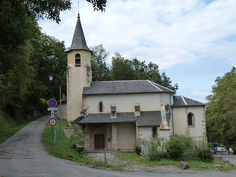
Photo: Thérèse Gaigé, CC BY-SA 3.0.
Chapelle du Saint-Crucifix is a church, which is situated 2 km west of Cordes 2 top landing.
Places in the Area
Nearby places include Cordes-sur-Ciel and Laguépie.
Cordes-sur-Ciel

Photo: Morestel, CC BY-SA 1.0.
Cordes-sur-Ciel is a town of about 800 people in Tarn. Cordes-sur-Ciel is a fortified town which was built in 1222 by Raimond VII, the Count of Toulouse.
Laguépie
Village

Photo: J. P. Le Ridant, CC BY-SA 3.0.
Laguépie is a commune in the Tarn-et-Garonne department in the Occitanie region in southern France. Laguépie is situated at the confluence of the rivers Aveyron and Viaur and at the tri-point of the departments Tarn-et-Garonne, Aveyron and Tarn. Laguépie is situated 9 km north of Cordes 2 top landing.
Cordes 2 top landing
- Type: Pitch
- Also known as: “Cordes saint marcel campes - cordes 2”
- Categories: recreation area, air sports, and sports location
- Location: Saint-Marcel-Campes, Arrondissement of Albi, Tarn, Occitanie, France, Europe
- View on OpenStreetMap
Latitude
44.06437° or 44° 3′ 52″ northLongitude
1.97705° or 1° 58′ 37″ eastElevation
296 metres (971 feet)Operator
Club wagga / ecole cap en cielNetwork
FFVLOpen location code
8FP33X7G+PROpenStreetMap ID
way 1235128868OpenStreetMap feature
leisure=pitchOpenStreetMap feature
sport=free_flying
This page is based on OpenStreetMap, Wikidata, and Wikimedia Commons.
We’d love your help improving our open data sources. Thank you for contributing.
Satellite Map
Discover Cordes 2 top landing from above in high-definition satellite imagery.
Notable Places Nearby
Highlights include Cordes saint marcel campes - cordes 2 and Cordes saint marcel campes test.
Nearby Places
Explore places such as Arbres beton and Bargade.
Tarn: Must-Visit Destinations
Delve into Albi, Carmaux, Cordes-sur-Ciel, and Gaillac.
Curious Pitches to Discover
Uncover intriguing pitches from every corner of the globe.
About Mapcarta. Data © OpenStreetMap contributors and available under the Open Database License". Text is available under the CC BY-SA 4.0 license, except for photos, directions, and the map. Photo: Wikimedia, CC0.