Puy-de-l’angle
Puy-de-l’angle is a pitch in Mont Dore, Arrondissement of Issoire, Auvergne-Rhône-Alpes and has an elevation of 1,730 metres. Puy-de-l’angle is situated nearby to the volcano Puy de Barbier, as well as near Puy de Mareilh.| Tap on a place to explore it |
Places of Interest Nearby
Highlights include Puy de l’Angle and Puy de Barbier.


Col de la Croix Saint-Robert
Mountain saddle
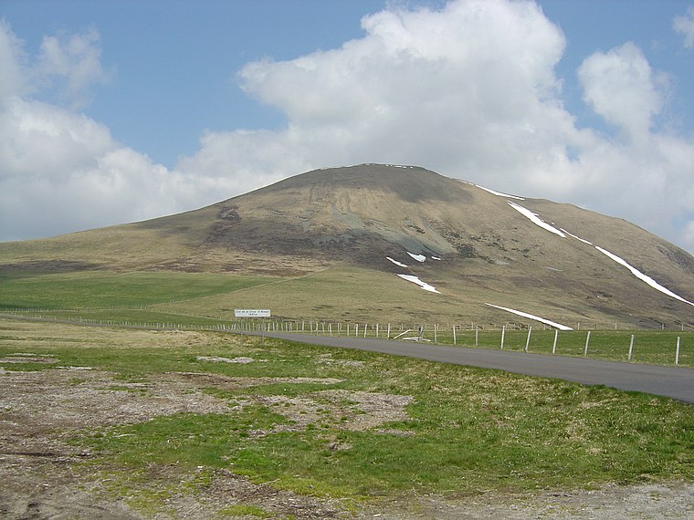
Photo: Anthospace, CC BY-SA 3.0.
Col de la Croix Saint-Robert is a mountain saddle.
Places in the Area
Nearby places include Besse-et-Saint-Anastaise.
Besse-et-Saint-Anastaise
Village

Photo: Torsade de Pointes, CC0.
Besse-et-Saint-Anastaise, also known as Besse-en-Chandesse, or Besse, is a commune in the Puy-de-Dôme department in Auvergne-Rhône-Alpes in central France. The nearby ski resort of Super-Besse hosted the first mountain finish of the 2008 Tour de France. Besse-et-Saint-Anastaise is situated 10 km southeast of Puy-de-l’angle.
Puy-de-l’angle
- Type: Pitch
- Categories: recreation area, air sports, and sports location
- Location: Mont Dore, Arrondissement of Issoire, Puy-de-Dôme, Auvergne, Auvergne-Rhône-Alpes, France, Europe
- View on OpenStreetMap
Latitude
45.57284° or 45° 34′ 22″ northLongitude
2.83986° or 2° 50′ 24″ eastElevation
1,730 metres (5,676 feet)Operator
C.d.v.l. puy-de-domeNetwork
FFVLOpen location code
8FQ4HRFQ+4WOpenStreetMap ID
way 1235463836OpenStreetMap feature
leisure=pitchOpenStreetMap feature
sport=free_flying
This page is based on OpenStreetMap, Wikidata, and Wikimedia Commons.
We’d love your help improving our open data sources. Thank you for contributing.
Satellite Map
Discover Puy-de-l’angle from above in high-definition satellite imagery.
Places with the Same Name
Discover other places named “Puy-de-l’angle”.
Notable Places Nearby
Highlights include Puy de Mareilh and Puy-de-mareuilh.
Nearby Places
Explore places such as Croix Saint Robert and Sauzet.
Auvergne: Must-Visit Destinations
Delve into Clermont-Ferrand, Vichy, Aurillac, and Le Puy-en-Velay.
Curious Pitches to Discover
Uncover intriguing pitches from every corner of the globe.
About Mapcarta. Data © OpenStreetMap contributors and available under the Open Database License". Text is available under the CC BY-SA 4.0 license, except for photos, directions, and the map. Photo: Torsade de Pointes, CC0.