Wohlleben Sports Rad
Wohlleben Sports Rad is a bike shop in Dörfles-Esbach, Landkreis Coburg, Bavaria which is located on Von-Werthern-Straße. Wohlleben Sports Rad is situated nearby to the playground Spielplatz Gartenäcker, as well as near the protected area Esbacher See.| Tap on a place to explore it |
- Opening hours:
Monday—Friday: 10:00 AM—6:00 PM
Saturday: 9:00 AM—5:00 PM - Type: Bike shop
- Address: Von-Werthern-Straße 4b, Dörfles-Esbach, 96487
Places of Interest Nearby
Highlights include Europäisches Museum für modernes Glas and Itztalbrücke.
Europäisches Museum für modernes Glas
Museum

Photo: Wikimedia, CC BY-SA 4.0.
Europäisches Museum für modernes Glas is situated 1½ km northeast of Wohlleben Sports Rad.
Itztalbrücke
Bridge
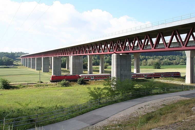
Photo: Störfix, CC BY-SA 3.0.
Itztalbrücke is a bridge, which is situated 1 km southeast of Wohlleben Sports Rad.
St. John (Oeslau)
Church

Photo: Störfix, CC BY-SA 3.0.
St. John (Oeslau) is a church, which is situated 2 km east of Wohlleben Sports Rad.
Places in the Area
Nearby places include Esbach and Dörfles bei Coburg.


Schloss Rosenau
Hamlet

Photo: Wikimedia, Public domain.
Schloss Rosenau, called in English The Rosenau or Rosenau Palace, is a former castle, converted into a ducal country house, near the town of Rödental, formerly in Saxe-Coburg, now lying in Bavaria, Germany.
Wohlleben Sports Rad
- Categories: building and shop
- Location: Dörfles-Esbach, Landkreis Coburg, Upper Franconia, Franconia, Bavaria, Germany, Central Europe, Europe
- View on OpenStreetMap
Latitude
50.28829° or 50° 17′ 18″ northLongitude
11.00505° or 11° 0′ 18″ eastOpen location code
9F2H72Q4+82OpenStreetMap ID
way 124067564OpenStreetMap feature
building=yesOpenStreetMap feature
shop=bicycle
This page is based on OpenStreetMap, Wikidata, and Wikimedia Commons.
We’d love your help improving our open data sources. Thank you for contributing.
Satellite Map
Discover Wohlleben Sports Rad from above in high-definition satellite imagery.
Notable Places Nearby
Highlights include Spielplatz Gartenäcker and Esbacher See.
Nearby Places
Explore places such as Wohlleben Sports and Reichenbacher Hamuel GmbH.
Upper Franconia: Must-Visit Destinations
Delve into Bamberg, Bayreuth, Coburg, and Hof.
Curious Bike Shops to Discover
Uncover intriguing bike shops from every corner of the globe.
About Mapcarta. Data © OpenStreetMap contributors and available under the Open Database License". Text is available under the CC BY-SA 4.0 license, except for photos, directions, and the map. Photo: Wikimedia, CC0.