Vereinsheim 1. FC Südring
Vereinsheim 1. FC Südring is a building in Bavaria, Germany. Vereinsheim 1. FC Südring is situated nearby to the ruins Eckertsmühle, as well as near Ruderclub Aschaffenburg.| Tap on a place to explore it |
Places of Interest Nearby
Highlights include Holy Cross Church and Stadion am Schönbusch.
Holy Cross Church
Church

Photo: Wikimedia, CC BY-SA 3.0.
Holy Cross Church is situated 620 metres northeast of Vereinsheim 1. FC Südring.
Stadion am Schönbusch
Stadium

Photo: Flunsch123, CC BY-SA 3.0.
Stadion am Schönbusch is a stadium, which is situated 1¼ km northwest of Vereinsheim 1. FC Südring.
Collegiate Church of St Peter and St Alexander
Church
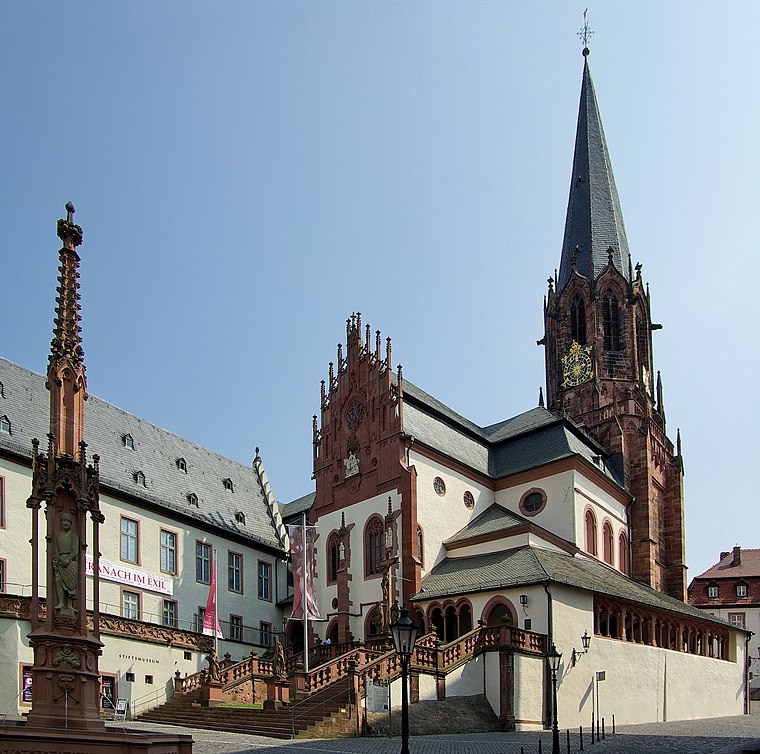
Photo: Wikimedia, CC BY-SA 3.0.
The church St. Peter und Alexander is a Catholic church located in Aschaffenburg, Bavaria, Germany. It is the town's oldest church, established in the 10th century, dedicated to Saint Peter and Saint Alexander. Collegiate Church of St Peter and St Alexander is situated 1½ km northeast of Vereinsheim 1. FC Südring.
Places in the Area
Nearby places include Aschaffenburg and Damm.
Aschaffenburg

Photo: Rainer Lippert, CC0.
Aschaffenburg is a city of 71,000 people in Lower Franconia. It is the largest city in the Bavarian Lower Main region. Because of its location, it is often referred to as the gateway to the Spessart.
Damm
Suburb

Photo: Dysmachus, CC BY-SA 3.0.
Damm is a suburb, which is situated 2½ km north of Vereinsheim 1. FC Südring.
Obernau
Village

Photo: Dysmachus, CC BY-SA 3.0.
Obernau is a village, which is situated 3 km south of Vereinsheim 1. FC Südring.
Vereinsheim 1. FC Südring
- Type: Football
- Categories: building and sports location
- Location: Bavaria, Germany, Central Europe, Europe
- View on OpenStreetMap
Latitude
49.96046° or 49° 57′ 38″ northLongitude
9.13695° or 9° 8′ 13″ eastOpen location code
8FXFX46P+5QOpenStreetMap ID
way 124573306OpenStreetMap feature
building=yesOpenStreetMap feature
sport=soccer
This page is based on OpenStreetMap, Wikidata, and Wikimedia Commons.
We’d love your help improving our open data sources. Thank you for contributing.
Satellite Map
Discover Vereinsheim 1. FC Südring from above in high-definition satellite imagery.
Notable Places Nearby
Highlights include Eckertsmühle and Ruderclub Aschaffenburg.
Nearby Places
Explore places such as iUS Institut für Umwelttechnologien und Strahlenschutz GmbH and Bauunternehmung Ph. Büttner GmbH.
Bavaria: Must-Visit Destinations
Delve into Munich, Nuremberg, Erlangen, and Augsburg.
Curious Places to Discover
Uncover intriguing places from every corner of the globe.
About Mapcarta. Data © OpenStreetMap contributors and available under the Open Database License". Text is available under the CC BY-SA 4.0 license, except for photos, directions, and the map. Photo: gravitat-OFF, CC BY 2.0.