Höbmannsbach
Höbmannsbach is an electrical substation in Taufkirchen an der Pram, Schärding District, Upper Austria. Höbmannsbach is situated nearby to the chapel Bründlkapelle, as well as near the village Sankt Florian am Inn.| Tap on a place to explore it |
Places of Interest Nearby
Highlights include Filialkirche hl. Laurentius, Wagholming and FF Rainbach.
Filialkirche hl. Laurentius, Wagholming
Church

Photo: Aberpram, CC BY-SA 3.0.
Filialkirche hl. Laurentius, Wagholming is a church, which is situated 1½ km south of Höbmannsbach.
FF Rainbach
Fire station
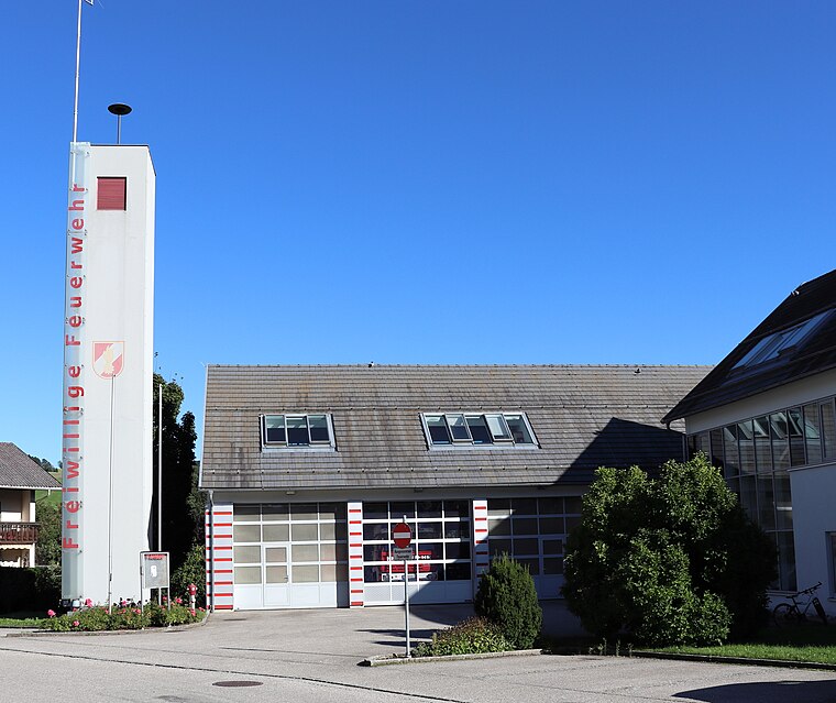
Photo: Samiclaus, CC BY-SA 4.0.
FF Rainbach is a fire station, which is situated 3 km northeast of Höbmannsbach.
Places in the Area
Nearby places include Sankt Florian am Inn and Unterfucking.
Sankt Florian am Inn
Village

Photo: Konrad Lackerbeck, CC BY 3.0.
Sankt Florian am Inn is a municipality in the district of Schärding in the Austrian state of Upper Austria. Sankt Florian am Inn is situated 6 km west of Höbmannsbach.
Unterfucking
Hamlet
Unterfucking is a populated place that is part of Sankt Marienkirchen bei Schärding, Schärding, Upper Austria, Austria. Unterfucking has often been included in lists of places with unusual names, due to the fact that part of its name bears a similarity to the English-language expletive "fuck". Unterfucking is situated 7 km southwest of Höbmannsbach.
Oberfucking
Hamlet

Photo: Croq, CC BY-SA 3.0.
Oberfucking is a populated place in Upper Austria, Austria. It is a part of the town St. Marienkirchen bei Schärding in district Schärding, near the border to Germany. Oberfucking is situated 7 km southwest of Höbmannsbach.
Höbmannsbach
- Type: Electrical substation
- Categories: building and industry
- Location: Taufkirchen an der Pram, Schärding District, Upper Austria, Austria, Central Europe, Europe
- View on OpenStreetMap
Latitude
48.43274° or 48° 25′ 58″ northLongitude
13.51675° or 13° 31′ 0″ eastOperator
Energie AG OberösterreichOpen location code
8FWMCGM8+3MOpenStreetMap ID
way 1249253584OpenStreetMap feature
building=transformer_tower
This page is based on OpenStreetMap, Wikidata, and Wikimedia Commons.
We’d love your help improving our open data sources. Thank you for contributing.
Satellite Map
Discover Höbmannsbach from above in high-definition satellite imagery.
Places with the Same Name
Discover other places named “Höbmannsbach”.
Notable Places Nearby
Highlights include FF. Höbmannsbach and Bründlkapelle.
Nearby Places
Explore places such as Baumgarten and Marterl.
Upper Austria: Must-Visit Destinations
Delve into Linz, Hallstatt, Wels, and Steyr.
Curious Electrical Substations to Discover
Uncover intriguing electrical substations from every corner of the globe.
About Mapcarta. Data © OpenStreetMap contributors and available under the Open Database License". Text is available under the CC BY-SA 4.0 license, except for photos, directions, and the map. Photo: Traveler100, CC BY-SA 3.0.