Nacogdoches Baseball Complex
Nacogdoches Baseball Complex is a sports venue in Nacogdoches, Texas which is located on Old Tyler Road. Nacogdoches Baseball Complex is situated nearby to the government office Nacogdoches Parks Department, as well as near the stadium SFA Softball Field.| Tap on a place to explore it |
Places of Interest Nearby
Highlights include Old Stone Fort Museum and Homer Bryce Stadium.
Old Stone Fort Museum
Museum
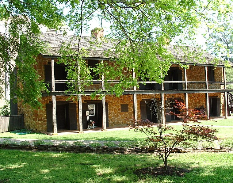
Photo: Wikimedia, Public domain.
The Old Stone Fort Museum is located on the campus of Stephen F. Austin State University, in the city and county of Nacogdoches, Texas. It is a 1936 replica, at a different location, of a structure that had been erected circa 1779 by Nacogdoches militia commander Antonio Gil Y'Barbo. Old Stone Fort Museum is situated 2 miles southeast of Nacogdoches Baseball Complex.
Homer Bryce Stadium
Stadium

Photo: Michael Barera, CC BY-SA 4.0.
Homer Bryce Stadium, located in Nacogdoches, Texas, is the home of Stephen F. Austin State University's Lumberjack football and Ladyjack and Lumberjack track and field events. Homer Bryce Stadium is situated 2 miles east of Nacogdoches Baseball Complex.
Places in the Area
Nearby places include Nacogdoches.
Nacogdoches
Nacogdoches is a city in East Texas and the county seat of Nacogdoches County, Texas, United States. The 2020 U.S. census recorded the city's population at 32,147.Nacogdoches Baseball Complex
- Type: Sports venue
- Address: 3715 Old Tyler Road, Nacogdoches, TX 75964
- Categories: baseball, recreation area, and sports location
- Location: Nacogdoches, Texas, United States, North America
- View on OpenStreetMap
Latitude
31.63494° or 31° 38′ 6″ northLongitude
-94.68076° or 94° 40′ 51″ westOperator
City of NacogdochesOpen location code
8637J8M9+XMOpenStreetMap ID
way 1250090937OpenStreetMap feature
leisure=sports_centreOpenStreetMap feature
sport=baseball
This page is based on OpenStreetMap, Wikidata, and Wikimedia Commons.
We’d love your help improving our open data sources. Thank you for contributing.
Satellite Map
Discover Nacogdoches Baseball Complex from above in high-definition satellite imagery.
Notable Places Nearby
Highlights include Nacogdoches Parks Department and SFA Softball Field.
Nearby Places
Explore places such as Rex Perry Autoplex and Nacogdoches County Exposition.
Texas: Must-Visit Destinations
Delve into Houston, Austin, Dallas, and San Antonio.
Curious Sports Venues to Discover
Uncover intriguing sports venues from every corner of the globe.
About Mapcarta. Data © OpenStreetMap contributors and available under the Open Database License". Text is available under the CC BY-SA 4.0 license, except for photos, directions, and the map. Photo: Wikimedia, CC0.