Quai François Mazeline
Quai François Mazeline is a pier in Le Havre, Seine-Maritime, Normandy. Quai François Mazeline is situated nearby to the pier Poste Minéralier, as well as near the dock Forme de Radoub n°7.| Tap on a place to explore it |
Places of Interest Nearby
Highlights include Docks Vauban and Les Bains Des Docks.
Docks Vauban
Shopping center
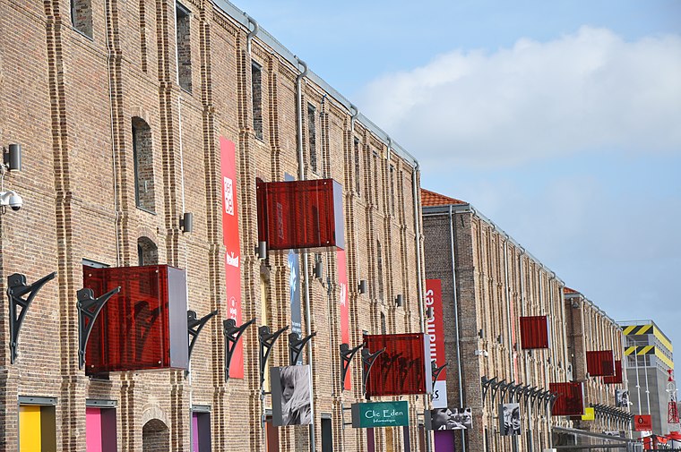
Photo: Wikimedia, CC BY-SA 4.0.
Docks Vauban is a shopping center, which is situated 1½ km north of Quai François Mazeline.
Les Bains Des Docks
Sports venue

Photo: syber76600, CC BY 2.0.
Les Bains Des Docks is an Aquatic Center in the city of Le Havre, France. It was designed by award winning architectural firm Ateliers Jean Nouvel as part of an effort by Le Havre to revitalize its docks and warehouse district. Les Bains Des Docks is situated 1½ km north of Quai François Mazeline.
Église Saint-Nicolas de Saint-Nicolas
Church

Photo: Palamède, CC BY-SA 4.0.
Église Saint-Nicolas de Saint-Nicolas is a church, which is situated 1¼ km north of Quai François Mazeline.
Places in the Area
Nearby places include Vasouy and Montivilliers.
Vasouy
Hamlet

Photo: Pymouss, CC BY-SA 3.0.
Vasouy is a hamlet, which is situated 8 km southeast of Quai François Mazeline.
Montivilliers
Town

Photo: Wikimedia, CC BY-SA 3.0.
Montivilliers is a commune in the Seine-Maritime department in the Normandy region in northern France. Montivilliers is situated 9 km northeast of Quai François Mazeline.
Honfleur

Photo: Iwiradi, CC BY-SA 3.0.
Honfleur is a town surrounding a beautiful little 17th-century harbour in Calvados, Normandy. It is still active as a fishing port and marina. The town has preserved many historic and traditional buildings and houses some interesting museums, churches and monuments.
Quai François Mazeline
- Type: Pier
- Category: transportation
- Location: Le Havre, Arrondissement of Le Havre, Seine-Maritime, Normandy, France, Europe
- View on OpenStreetMap
Latitude
49.47469° or 49° 28′ 29″ northLongitude
0.1297° or 0° 7′ 47″ eastOpen location code
8FX2F4FH+VVOpenStreetMap ID
way 125506990OpenStreetMap feature
man_made=pier
This page is based on OpenStreetMap, Wikidata, and Wikimedia Commons.
We’d love your help improving our open data sources. Thank you for contributing.
Satellite Map
Discover Quai François Mazeline from above in high-definition satellite imagery.
Notable Places Nearby
Highlights include Poste Minéralier and Poste 7.
Nearby Places
Explore places such as Écriteau Le Havre and déflecteur.
Normandy: Must-Visit Destinations
Delve into Orne, Rouen, Seine-Maritime, and Caen.
Curious Piers to Discover
Uncover intriguing piers from every corner of the globe.
About Mapcarta. Data © OpenStreetMap contributors and available under the Open Database License". Text is available under the CC BY-SA 4.0 license, except for photos, directions, and the map. Photo: Palamède, CC BY-SA 3.0.