Templo de San Luis Gonzaga y Santo Toribio Romo
Templo de San Luis Gonzaga y Santo Toribio Romo is a church in Guadalajara, Jalisco. Templo de San Luis Gonzaga y Santo Toribio Romo is situated nearby to the marketplace Mercado Severo Diaz, as well as near the university Centro De Estudios E Investigaciones De Bioetica.| Tap on a place to explore it |
Places of Interest Nearby
Highlights include Monumento a los Niños Héroes and Mexicaltzingo light rail station.
Monumento a los Niños Héroes
Memorial

Photo: Pancho GDL, CC BY-SA 4.0.
The Monumento a los Niños Héroes is a monument in Guadalajara, in the Mexican state of Jalisco. The monument is located in a roundabout that was later intervened by activists, who symbolically renamed it as the Glorieta de las y los desaparecidos. Monumento a los Niños Héroes is situated 320 metres west of Templo de San Luis Gonzaga y Santo Toribio Romo.
Mexicaltzingo light rail station
Railway stop
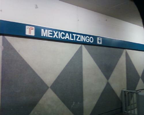
Photo: Qk-racho, CC BY-SA 3.0.
The Mexicaltzingo railway station is part of the Sistema de Tren Eléctrico Urbano in the Mexican state of Jalisco. Mexicaltzingo light rail station is situated 1 km east of Templo de San Luis Gonzaga y Santo Toribio Romo.
Washington
Railway stop

Photo: Elmerhomerochombo, CC BY-SA 4.0.
Washington is a railway stop, which is situated 1 km southeast of Templo de San Luis Gonzaga y Santo Toribio Romo.
Templo de San Luis Gonzaga y Santo Toribio Romo
- Type: Church
- Denomination: Catholic
- Categories: place of worship and religion
- Location: Guadalajara, Jalisco, Pacific Coast, Mexico, North America
- View on OpenStreetMap
Latitude
20.66661° or 20° 39′ 60″ northLongitude
-103.36542° or 103° 21′ 56″ westOpen location code
75GRMJ8M+JROpenStreetMap ID
way 125568781OpenStreetMap feature
amenity=place_of_worshipOpenStreetMap attribute
denomination=catholic
This page is based on OpenStreetMap, Wikidata, and Wikimedia Commons.
We’d love your help improving our open data sources. Thank you for contributing.
Satellite Map
Discover Templo de San Luis Gonzaga y Santo Toribio Romo from above in high-definition satellite imagery.
Notable Places Nearby
Highlights include Mercado Severo Diaz and Centro De Estudios E Investigaciones De Bioetica.
Nearby Places
Explore places such as Colonias and Baking Art.
Jalisco: Must-Visit Destinations
Delve into Puerto Vallarta, Tequila, Tepatitlan, and Lagos de Moreno.
Curious Churches to Discover
Uncover intriguing churches from every corner of the globe.
About Mapcarta. Data © OpenStreetMap contributors and available under the Open Database License". Text is available under the CC BY-SA 4.0 license, except for photos, directions, and the map. Photo: Wikimedia, CC0.