Sand- und Kiesgrube Hermann Dickhof GmbH
Sand- und Kiesgrube Hermann Dickhof GmbH is a quarry in Viersen, Düsseldorf, North Rhine-Westphalia. Sand- und Kiesgrube Hermann Dickhof GmbH is situated nearby to the church Kapelle Lind, as well as near Wegekapelle Loosen.| Tap on a place to explore it |
Places of Interest Nearby
Highlights include St. Mary Helper of the Christians and Boisheim station.
St. Mary Helper of the Christians
Church

Photo: Wikimedia, Public domain.
St. Mary Helper of the Christians is a church, which is situated 2 km north of Sand- und Kiesgrube Hermann Dickhof GmbH.
Boisheim station
Railway station
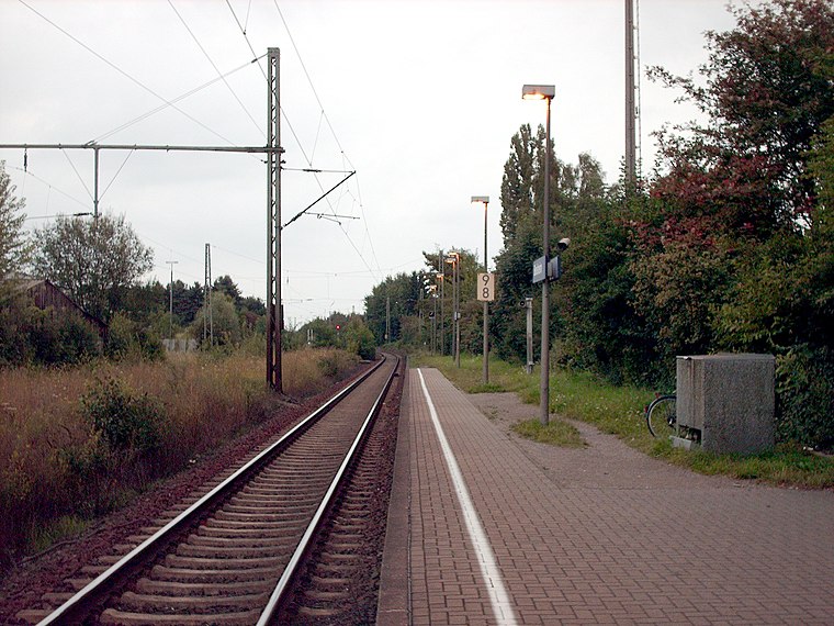
Photo: Stefan Flöper, CC BY-SA 4.0.
Boisheim is a railway station located in Boisheim, Germany. The station opened on 29 January 1866, and is located on the Viersen–Venlo railway. The train services are operated by Eurobahn. Boisheim station is situated 3 km west of Sand- und Kiesgrube Hermann Dickhof GmbH.
St. Cornelius
Church
 St. Cornelius is a church, which is situated 2½ km southeast of Sand- und Kiesgrube Hermann Dickhof GmbH.
Places in the Area
Nearby places include Dülken and Süchteln.
Dülken
Town

Photo: Stefan Flöper, CC BY-SA 4.0.
Dülken is a town located in the North Rhine-Westphalia state of Germany. It has a population of about 20,000. It is a borough of the municipality of Viersen. Dülken is situated 2½ km southeast of Sand- und Kiesgrube Hermann Dickhof GmbH.
Süchteln
Town
Süchteln is a borough of Viersen, a town which is the centre of the Kreis of Viersen in North Rhine-Westphalia, Germany. Süchteln was formerly an independent town; the Catholic parish church of St Clement is at its centre. Süchteln is situated 4½ km northeast of Sand- und Kiesgrube Hermann Dickhof GmbH.
Lobberich
Town

Photo: O.Falkner, CC BY-SA 3.0.
Lobberich is a German village in North Rhine-Westphalia, situated close to the Dutch border at Venlo. It has a population of around 14,000 inhabitants. Lobberich is situated 5 km northwest of Sand- und Kiesgrube Hermann Dickhof GmbH.
Sand- und Kiesgrube Hermann Dickhof GmbH
- Type: Quarry
- Category: industry
- Location: Viersen, Düsseldorf, North Rhine-Westphalia, Germany, Central Europe, Europe
- View on OpenStreetMap
Latitude
51.27035° or 51° 16′ 13″ northLongitude
6.31424° or 6° 18′ 51″ eastOpen location code
9F3878C7+4MOpenStreetMap ID
way 1264741825OpenStreetMap feature
landuse=quarry
This page is based on OpenStreetMap, Wikidata, and Wikimedia Commons.
We’d love your help improving our open data sources. Thank you for contributing.
Satellite Map
Discover Sand- und Kiesgrube Hermann Dickhof GmbH from above in high-definition satellite imagery.
Notable Places Nearby
Highlights include Kapelle Lind and Wegekapelle Loosen.
Nearby Places
Explore places such as Schwegershof and Solarpark Viersen Reimesheide.
North Rhine-Westphalia: Must-Visit Destinations
Delve into Cologne, Düsseldorf, Bonn, and Dortmund.
Curious Quarries to Discover
Uncover intriguing quarries from every corner of the globe.
About Mapcarta. Data © OpenStreetMap contributors and available under the Open Database License". Text is available under the CC BY-SA 4.0 license, except for photos, directions, and the map. Photo: Daniel Schwen, CC BY-SA 2.5.