Pavilhão
Pavilhão is a sports venue in Anha, Viana do Castelo. Pavilhão is situated nearby to the sports venue Piscina do Centro Social Paroquial de Vila Nova de Anha, as well as near the church Capela de Santo António.| Tap on a place to explore it |
Places of Interest Nearby
Highlights include Darque train station and Castelo de Portuzelo.
Darque train station
Railway stop
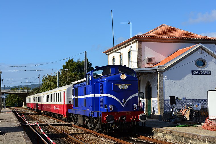
Photo: Nelso Silva, CC BY-SA 2.0.
Darque train station is a railway stop, which is situated 1¼ km north of Pavilhão.
Castelo de Portuzelo
Castle
Castelo de Portuzelo is a castle in Portugal. It is classified by IGESPAR as a Site of Public Interest. Castelo de Portuzelo is situated 4 km north of Pavilhão.
Quinta de São Cristóvão da Portela
Farm

Photo: Susana Pereira, CC BY-SA 3.0.
Quinta de São Cristóvão da Portela is a farm, which is situated 3½ km east of Pavilhão.
Places in the Area
Nearby places include Anha and Mazarefes.
Anha
Town

Photo: Barbarafpoliveira, CC BY-SA 4.0.
Anha or Vila Nova do Anha is a civil parish in the municipality of Viana do Castelo, Portugal. The population in 2011 was 2,415, in an area of 9.40 km2. Town status was given in July 1985.
Mazarefes
Village
Mazarefes was a civil parish in the municipality of Viana do Castelo, Portugal, with a population of 1 343 inhabitants. Since 2013, it was merged with the parish of Vila Fria, forming Mazarefes e Vila Fria.
Darque
Town
Darque is a civil parish in the municipality of Viana do Castelo, Portugal. The population in 2011 was 7,817, in an area of 9.01 km2.
Pavilhão
- Type: Sports venue
- Categories: building and sports location
- Location: Anha, Viana do Castelo, Viana do Castelo District, Portugal, Iberia, Europe
- View on OpenStreetMap
Latitude
41.66803° or 41° 40′ 5″ northLongitude
-8.78323° or 8° 46′ 60″ westOpen location code
8CHHM698+6POpenStreetMap ID
way 1265686070OpenStreetMap feature
building=sports_hall
This page is based on OpenStreetMap, Wikidata, and Wikimedia Commons.
We’d love your help improving our open data sources. Thank you for contributing.
Satellite Map
Discover Pavilhão from above in high-definition satellite imagery.
Places with the Same Name
Discover other places named “Pavilhão”.
Notable Places Nearby
Highlights include Piscina do Centro Social Paroquial de Vila Nova de Anha and Capela de Santo António.
Nearby Places
Explore places such as Escola Básica e Secundária de Monte da Ola and Reservatório do Monte da Ola.
Portugal: Must-Visit Destinations
Delve into Lisbon, Caldas da Rainha, Porto, and Coimbra.
Curious Sports Venues to Discover
Uncover intriguing sports venues from every corner of the globe.
About Mapcarta. Data © OpenStreetMap contributors and available under the Open Database License". Text is available under the CC BY-SA 4.0 license, except for photos, directions, and the map. Photo: bob, CC BY 2.0.