Landwacht
Landwacht is a residential area in Göttingen, Southern Lower Saxony, Lower Saxony. Landwacht is situated nearby to the playground Pächterstraße, as well as near the suburb Herberhausen.| Tap on a place to explore it |
Places of Interest Nearby
Highlights include Hainberg and Bismarck Tower (Göttingen).

Bismarck Tower (Göttingen)
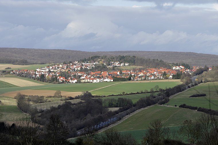
Scenic viewpoint

Photo: mibuchat, CC BY-SA 2.0.
Bismarck Tower (Göttingen) is a scenic viewpoint, which is situated 2 km southwest of Landwacht.
Tuchmacherborn
Spring

Photo: Nemracc, CC BY-SA 4.0.
Tuchmacherborn is a spring, which is situated 1½ km south of Landwacht.
Places in the Area
Nearby places include Herberhausen and Roringen.
Herberhausen
Suburb

Photo: Dehio, CC BY-SA 3.0.
Herberhausen is a village belonging to Göttingen, Lower Saxony, in Germany.
Roringen
Suburb
 Roringen is a village in the borough of Göttingen, Germany. High on a hill, it is separated from the city proper some 51⁄2 km to the south-west by farmlands and part of the Göttingen Forest. Roringen is situated 2½ km northeast of Landwacht.
Nikolausberg
Suburb

Photo: Forty2, CC BY-SA 3.0.
Nikolausberg is a northeastern borough of the university town of Göttingen, Germany. Its name derives from a legend according to which three pilgrims came to the church in 999 AD, of whom one left relics of Nicholas of Myra following his death there. Nikolausberg is situated 3 km north of Landwacht.
Landwacht
- Type: Residential area
- Location: Göttingen, Göttingen, Southern Lower Saxony, Lower Saxony, Germany, Central Europe, Europe
- View on OpenStreetMap
Latitude
51.53778° or 51° 32′ 16″ northLongitude
9.98903° or 9° 59′ 21″ eastOpen location code
9F3FGXQQ+4JOpenStreetMap ID
way 1265827808OpenStreetMap feature
landuse=residential
This page is based on OpenStreetMap, Wikidata, and Wikimedia Commons.
We’d love your help improving our open data sources. Thank you for contributing.
Satellite Map
Discover Landwacht from above in high-definition satellite imagery.
Notable Places Nearby
Highlights include Pächterstraße and DHL.
Nearby Places
Explore places such as Kindertagesstätte Zum hohen Brunnen and Friedrichs.
Southern Lower Saxony: Must-Visit Destinations
Delve into Goslar, Hamelin, Hann. Münden, and Einbeck.
Curious Residential Areas to Discover
Uncover intriguing residential areas from every corner of the globe.
About Mapcarta. Data © OpenStreetMap contributors and available under the Open Database License". Text is available under the CC BY-SA 4.0 license, except for photos, directions, and the map. Photo: Nastoshka, CC BY-SA 4.0.