Halifax (Queen Elzabeth II Health Sciences Centre) Heliport
Halifax (Queen Elzabeth II Health Sciences Centre) Heliport is a helipad in Halifax, Halifax Region, Nova Scotia. Halifax (Queen Elzabeth II Health Sciences Centre) Heliport is situated nearby to the hospital Halifax Infirmary, as well as near the power station Camp Hill Power Plant.| Tap on a place to explore it |
Places of Interest Nearby
Highlights include Nova Scotia Museum of Natural History and Wanderers Grounds.
Nova Scotia Museum of Natural History
Museum

Photo: Hal peridol, CC BY-SA 3.0.
The Nova Scotia Museum of Natural History, part of the Nova Scotia Museum, is located in downtown Halifax, Nova Scotia. The museum includes collections and exhibits concerning the natural sciences as well as artifacts of cultural significance to Nova Scotia. Nova Scotia Museum of Natural History is situated 140 metres east of Halifax (Queen Elzabeth II Health Sciences Centre) Heliport.
Wanderers Grounds
Park
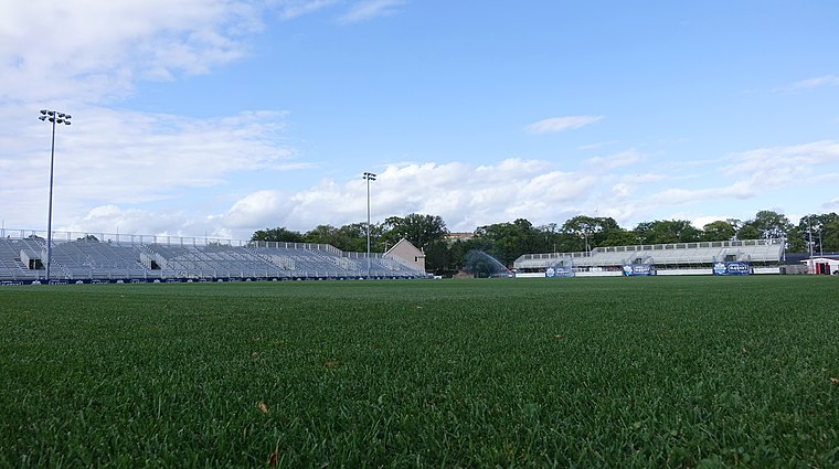
Photo: Coastal Elite, CC BY-SA 2.0.
Wanderers Grounds is a sporting complex in Halifax, Nova Scotia, and home to Canadian Premier League professional soccer club HFX Wanderers FC. The grounds are part of the Halifax Commons. Wanderers Grounds is situated 270 metres east of Halifax (Queen Elzabeth II Health Sciences Centre) Heliport.
Scotiabank Centre
Stadium
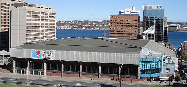
Photo: Bryson109, Public domain.
Scotiabank Centre is the largest multi-purpose facility in Atlantic Canada, located in downtown Halifax, Nova Scotia. The main entrances to the building are located on Brunswick Street, at the corner of Duke Street and Carmichael Street, at the foot of Citadel Hill. Scotiabank Centre is situated 1 km east of Halifax (Queen Elzabeth II Health Sciences Centre) Heliport.
Places in the Area
Nearby places include North End and Hydrostone.
North End
Locality

Photo: Citobun, CC BY-SA 4.0.
The North End of Halifax is a neighbourhood of Halifax, Nova Scotia occupying the northern part of Halifax Peninsula immediately north of Downtown Halifax.
Hydrostone
Neighborhood
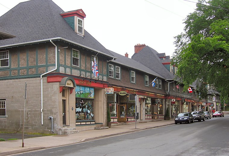
Photo: Verne Equinox, CC BY-SA 3.0.
Hydrostone is a neighbourhood in the North End of the Halifax Peninsula in the Halifax Regional Municipality, Nova Scotia, Canada. It consists of ten short parallel streets and is bordered by Duffus Street to the north, Young Street to the south, Isleville Street to the west and Novalea Drive to the east.
Armdale
Locality
Armdale is a neighbourhood of the community of Halifax, Nova Scotia, Canada. Armdale is situated 3 km west of Halifax (Queen Elzabeth II Health Sciences Centre) Heliport.
Halifax (Queen Elzabeth II Health Sciences Centre) Heliport
- Type: Helipad
- Category: transportation
- Location: Halifax, Halifax Region, Nova Scotia, Atlantic Canada, Canada, North America
- View on OpenStreetMap
Latitude
44.64594° or 44° 38′ 45″ northLongitude
-63.58663° or 63° 35′ 12″ westOpen location code
87PRJCW7+98OpenStreetMap ID
way 1265907946OpenStreetMap feature
aeroway=helipad
This page is based on OpenStreetMap, Wikidata, and Wikimedia Commons.
We’d love your help improving our open data sources. Thank you for contributing.
Satellite Map
Discover Halifax (Queen Elzabeth II Health Sciences Centre) Heliport from above in high-definition satellite imagery.
Notable Places Nearby
Highlights include Halifax Infirmary and Camp Hill Power Plant.
Nearby Places
Explore places such as Orthopedic Assessment Clinic and Halifax Infirmary.
Halifax Region: Must-Visit Destinations
Delve into Dartmouth, Enfield, Peggy’s Cove, and Bedford.
Curious Helipads to Discover
Uncover intriguing helipads from every corner of the globe.
About Mapcarta. Data © OpenStreetMap contributors and available under the Open Database License". Text is available under the CC BY-SA 4.0 license, except for photos, directions, and the map. Photo: Balou46, CC BY-SA 4.0.