Christian & Missionary Alliance Sun Kei Secondary School
Christian and Missionary Alliance Sun Kei Secondary School is an Evangelical Christian Secondary School which is located in 6 Tong Chun Street, Tseung Kwan O, Hong Kong.| Tap on a place to explore it |
Photo: 建園春秋, CC BY-SA 4.0.
- Type: School
- Description: secondary school in Hong Kong
- Also known as: “Christian and Missionary Alliance Sun Kei Secondary School”
- Address: 6 唐俊街 Tong Chun Street
Places of Interest Nearby
Highlights include Yan Chai Hospital Wong Wha San Secondary School and PopCorn.

PopCorn
Shopping center

Photo: Wpcpey, CC BY-SA 4.0.
PopCorn is a shopping center, which is situated 200 metres south of Christian & Missionary Alliance Sun Kei Secondary School.
Tseung Kwan O Sports Ground
Stadium
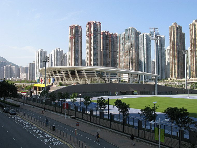
Photo: Baycrest, CC BY-SA 2.5.
Tseung Kwan O Sports Ground, located in Tseung Kwan O, Hong Kong, is a multi-purpose sports ground and home of Hong Kong Premier League club Eastern. It was the main venue for track and field events for the 2009 Hong Kong Games, 2009 East Asian Games and 2011 Hong Kong Games. Tseung Kwan O Sports Ground is situated 420 metres east of Christian & Missionary Alliance Sun Kei Secondary School.
Places in the Area
Nearby places include Tseung Kwan O and Yau Yue Wan Resite Village.
Tseung Kwan O
Town

Photo: Wing1990hk, CC BY 3.0.
Junk Bay, also known by its Chinese transliteration Tseung Kwan O or Cheung Kwan O; is a bay in Sai Kung District, New Territories, Hong Kong. In the northern tip of the bay lies the Tseung Kwan O Village.
Yau Yue Wan Resite Village
Hamlet
Yau Yue Wan Village is a village in the Po Lam area of Tseung Kwan O, in the Sai Kung District of Hong Kong.
Tseung Kwan O Village
Village

Photo: Vinceng3, Public domain.
Tseung Kwan O Village is a community in the Tseung Kwan O area, in the Sai Kung District of Hong Kong.
Christian & Missionary Alliance Sun Kei Secondary School
- Categories: secondary school and education
- Location: Hong Kong, East Asia, Asia
- View on OpenStreetMap
Latitude
22.30981° or 22° 18′ 35″ northLongitude
114.25975° or 114° 15′ 35″ eastOpen location code
7PJP8755+WVOpenStreetMap ID
way 126688984OpenStreetMap feature
amenity=schoolWikidata ID
Q5110305
This page is based on OpenStreetMap, Wikidata, Wikimedia Commons, and Wikipedia.
We’d love your help improving our open data sources. Thank you for contributing.
Satellite Map
Discover Christian & Missionary Alliance Sun Kei Secondary School from above in high-definition satellite imagery.
In Other Languages
From Chinese to Japanese—“Christian & Missionary Alliance Sun Kei Secondary School” goes by many names.
- Chinese: “基督教宣道會宣基中學”
- Japanese: “基督教宣道会宣基中学”
Notable Places Nearby
Highlights include Tong Ming Street Sitting-out Area and Tong Ming Street Park.
Nearby Places
Explore places such as Chi Lin Buddhist Primary School and Chi Lin Buddhist Primary School.
Hong Kong: Must-Visit Destinations
Delve into Kowloon, Hong Kong International Airport, Outlying Islands, and Central Hong Kong.
Curious Places to Discover
Uncover intriguing places from every corner of the globe.
About Mapcarta. Data © OpenStreetMap contributors and available under the Open Database License". Text is available under the CC BY-SA 4.0 license, except for photos, directions, and the map. Description text is based on the Wikipedia page “Christian & Missionary Alliance Sun Kei Secondary School”. Photo: 建園春秋, CC BY-SA 4.0.